IEEE/ION PLANS 2020
The Position Location and Navigation Symposium (PLANS) is a biennial technical conference that occurs in the spring of even numbered years. Our mission is to provide a forum to share the latest advances in navigation technology.
The PLANS conference is a four day conference with 1 day dedicated to tutorials and three days to technical sessions. The tutorials provide attendees with the opportunity to learn about navigation technology from well-known industry experts. A variety of tutorials are offered to serve the professional needs of both newcomers and those well versed in the field of navigation.
Twenty-four half-day technical sessions are offered over a three day period, with four sessions running simultaneously each morning and afternoon. At the technical sessions scientists, researchers and engineers from around the world present their latest work in the field of navigation.
The 14th IALA Symposium

The Netherlands Ministry of Infrastructure and Water Management together with IALA are the host organizations for the 14th IALA Symposium to be held from 25-29 May 2020 in the WTC, Rotterdam, The Netherlands.
This event will be the first Symposium of its kind combining the topics of modern Vessel Traffic Services (VTS) and the implementation of maritime services under the e-Navigation concept.
Red vegetation
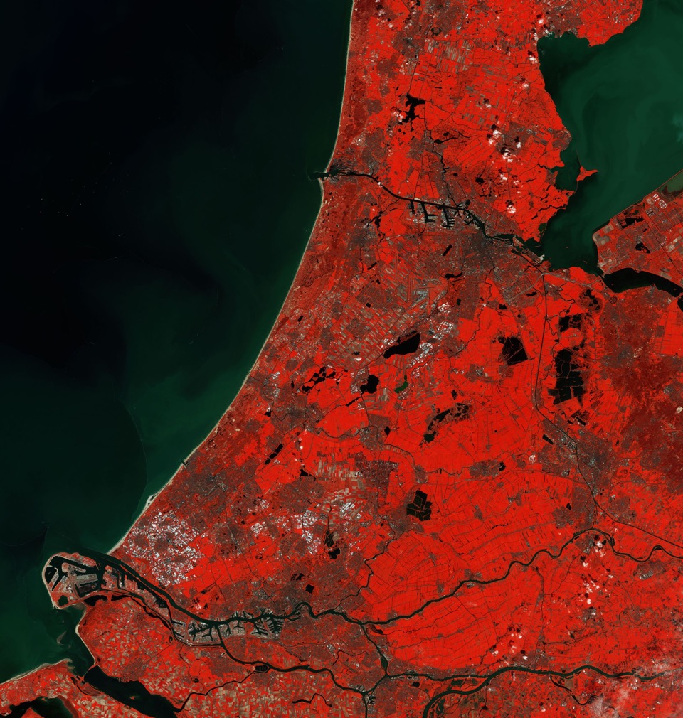
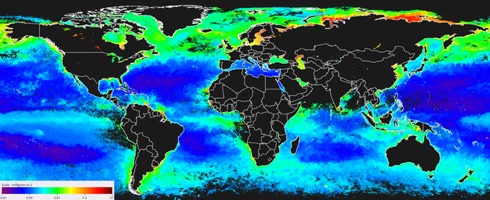
By kind courtesy of the news service provided by the European Space Agency (ESA) readers can view The Netherlands featured in this false-colour image captured by the Copernicus Sentinel-2 mission. This image was processed in a way that included the near-infrared channel, which makes vegetation appear bright red.
To the north of The Hague is the coastal town of Noordwijk, home to ESA’s European Space Technology Research Centre (ESTEC).
ESTEC is ESA’s technical centre where new missions are designed, their industrial development managed and, in some cases, spacecraft and instruments are tested.
CANSO secures support for key ATM recommendations to States and ICAO

It was reported from Montreal on 4 October 2019 that the Civil Air Navigation Services Organisation (CANSO) has secured support for four key recommendations from States and ICAO, recommendations it has made during the 40th ICAO Assembly.
These covered:
– The need for improving guidance and directions to states on securing cyber resilience in aviation;
– Building capacity in ATM through adequate funding and flexible ANSP models;
– Improving the efficiency of ATM through required navigation performance (RNP);
– Securing future services through adherence to key principles and mutual value.
Red Arrows over the Golden Gate Bridge

Our illustration shows the Royal Air Force Aerobatic Team, The Red Arrows, flying past the Golden Gate Bridge, San Francisco, trailing the red, white and blue smoke over the bridge on 1 October.
Currently, The Red Arrows are deployed on Exercise WESTERNHAWK 2019.
According to the Ministry of Defence this is the first time the Red Arrows have been to North America since 2008 and the deployment will be the most ambitious tour of Canada and the United States ever undertaken by the team – going coast-to-coast.
Amery Ice Shelf

Our illustration kindly provided by the European Space Agency (ESA) on 1 October indicates that a huge iceberg has broken off the Amery Ice Shelf in Antarctica.
Dubbed D28, the iceberg is around 1600 sq km – about the size of Greater London. It is approximately 30 km wide and 60 km long, and is estimated to weigh over 300 billion tonnes.
An IAAC Workshop Foundations of Formation Control: Theory and Applications
We were informed by Moshe Idan, IAAC President, that this event will be held on 11 November in the Daniel Hotel, Herzelia.
This workshop is organized by Professor Daniel Zelazo from the Technion and will be delivered by him and Professor Angelo Cenedese of the University of Padua, Italy.
Stena Impero under way at last
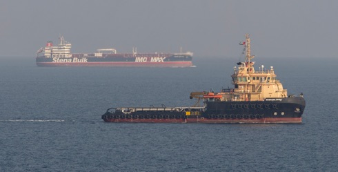
Our image here is of the mv Stena Impero seen here sailing from Bandar Abbas (Iran), en route to Dubai after being released by Iranian officials on 27 September.
Erik Hanell, President and CEO, Stena Bulk commented: ‘The Stena Impero has now left Iranian waters and is on route to Dubai. The Master has reported that all crew members are safe and in high spirits following release. Upon arrival, the crew will receive medical checks and de-briefing by the Company, following which arrangements have been made for them to return directly to their families in their respective countries.’
ION GNSS+ Conference in Miami, Florida


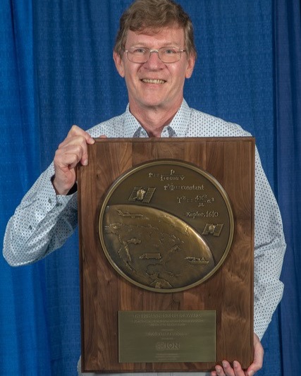
Dr Diaz was recognized for graduate student excellence in Global Navigation Satellite Systems in his thesis, Design of an Integrity Support Message for Offline Advanced RAIM.
Professor Teunissen was recognized for his influential and ground-breaking contributions to the algorithmic foundations of satellite navigation, and for sustained dedication to the global education of the next generation of navigation engineers.
The Navigation Flashlight
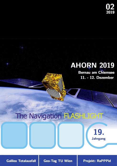
From our Austrian member institute, the Österreichischer Verein für Navigation, we have received word of the latest issue of their regular publication, The Navigation Flashlight. It is published three times a year, currently in its nineteenth year of publication and it is in German.
Reminder: Von 11.-12. Dezember 2019 findet in Bernau am Chiemsee die Ahorn 2019 statt. Die Deadline für die Einreichung von Tagungsbeiträgen ist der 27. September 2019! Genauere Informationen unter: https://www.dgon-ahorn.org/de/home.html
Ausserdem findet am 12. November 2019 das nächste Navigations Get-Together an der TU Wien statt. Sie sind herzlich dazu eingeladen! Genauere Informationen folgen noch.
ION ITM PTTI 2020

The deadline for submitting abstracts for the ION co-located International Technical Meeting (ITM) and Precise Time and Time Interval (PTTI) Systems and Applications Meeting 2020 is 10 October.
Abstracts may currently be submitted for the co-located ION ITM/PTTI 2020 conference to be held from 21 to 24 January 2020 at the Hyatt Regency Mission Bay in San Diego, California.
UK Met Office to receive £20 million

On 24 September the UK Government announced £20 million of new funding to help the nation cope with the potential impacts of space weather events.
This funding, from the Government’s Strategic Priorities Fund, will support research projects aimed at improving the ability of the Met Office to predict space weather events and therefore reduce their potential impact.
A new lighthouse tender planned for the UK
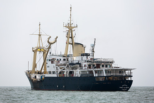
On 9 September at the start of this year’s London International Shipping Week Nusrat Ghani, Maritime Minister on behalf of HMG, confirmed that it will enable construction of a new advanced ship for the General Lighthouse Authority, Trinity House, to replace the ageing THV Patricia, built in 1982 by Henry Robb of Leith.
The vessel, yet to be named, will establish and service aids to navigation in some of the most dangerous waters of NW Europe, marking channels and hazards and using the latest technology.
Harnessing artificial intelligence for climate science
On 18 September the European Space Agency (ESA) reported that over 700 Earth observation satellites are orbiting our planet, transmitting hundreds of terabytes of data to downlink stations every day. Processing and extracting useful information is a huge data challenge, with volumes rising quasi- exponentially.
The news item from ESA informed that artificial intelligence algorithms – computer systems that learn and act in response to their environment – can improve detection rates in Earth observation. For example, it is common to use the ‘random forests’ algorithm, which uses a training dataset to learn to detect different land-cover types or areas burnt by wildfires. In machine learning, computer algorithms are trained, in the statistical sense, to split, sort and transform data to improve dataset classification, prediction, or pattern discovery.
Using artificial intelligence to automate sea-ice charting


Reliable charts of sea-ice conditions and forecasts are of vital importance for maritime safety, safe navigation and planning. The continued retreating and thinning of Arctic sea ice calls for a more effective way of producing detailed and timely ice information – which is where artificial intelligence comes in. This was reported in a feature by the European Space Agency (ESA) on 10 September.
The Danish Meteorological Institute (DMI), the Technical University of Denmark and Harnvig Arctic & Maritime have initiated the project known as Automated Sea Ice Products (ASIP) – funded by the Innovation Fund Denmark. This project aims to develop an automatic sea-ice service that can provide more timely and detailed sea-ice information to improve efficiency and safety of marine operations in the Arctic.
ASIP merges Copernicus Sentinel-1 imagery with other satellite sensor data, such as passive microwave data from the Advanced Microwave Scanning Radiometer 2 (AMSR2) to resolve ambiguities that can occur in SAR imagery, such as during windy sea conditions. ASIP uses a convolutional neural network system that is trained with vast datasets of ice charts, to generate ice maps automatically.
EU aviation stakeholders sign joint declaration on the future of the Single European Sky (SES)
In Brussels on 11 September signatories called up on the EU Institutions and Members States to take the necessary steps to implement the joint declaration adopted that day, outlining their shared commitment to improving Europe’s airspace.
At the Digital European Sky conference, organised under the Finnish Presidency of the EU, representatives of 21 EU aviation and workers’ associations were due to sign a joint declaration committing to a set of concrete actions to finally and fully implement the vision of a Single European Sky (SES).
The joint declaration will be sending a strong signal that the SES vision can only be achieved through the collaborative and coordinated efforts of all stakeholders, including Member States and the European Institutions.
Lack of documentation, ineffective procedures contribute to improper removal of landing gear locks
In preparation for an August 2018 scheduled flight from Perth Airport to Christmas Island, an apron engineer fitted landing gear ground locks (LGGL) to an Airbus A320 before it was towed to its departure bay. The apron engineer then went to supervise the refuelling of another aircraft, with the intention of returning for the refuelling of the A320 and removing the LGGL.
Approximately 40 minutes later, a flight crew member’s pre-flight walk-around identified the presence of the LGGL. The captain acknowledged the flight crew member’s observation but anticipated that normal departure procedures would lead to the removal of the LGGL before flight.
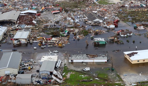
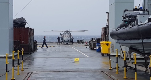
Coasties and team hard at work
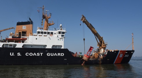
Crew members aboard the Coast Guard Cutter Willow and a Station Charleston Response Boat-Medium performed aids to navigation maintenance and harbour assessment patrols in the Port of Charleston on 7 September.
Coast Guard personnel worked with the Army Corps of Engineers, South Carolina and Georgia Ports Authorities, regional pilots’ associations, and multiple port partners to rapidly reopen the ports of Charleston, Savannah, and Brunswick restoring the vital flow of commerce in the region following Hurricane Dorian.
Towards e-navigation in Asia-Pacific
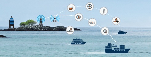
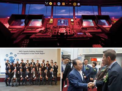
Without doubt the implementation of e-navigation – the user-friendly collection, harmonization and display of essential maritime information – will contribute to enhanced maritime safety and security and support efficient shipping while protecting the marine environment. Various e-navigation solutions are being developed, taking into account IMO guidance and regulations.
The SMART-Navigation Project, organized and funded by the Ministry of Oceans and Fisheries, Republic of Korea, was presented during an IMO regional workshop on e-navigation for the Asia-Pacific region, held in Busan, Republic of Korea from 4-6 September. This was reported by the IMO media service on 6 September.
RIN INC reminder
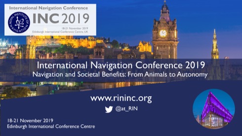
“We believe strongly in the value of bringing people together to share knowledge, perspectives and insights. We strive to make INC an enriching experience for all delegates, irrespective of experience or discipline.
The format of INC is designed to offer more keynote speakers – to set the scene for the session papers; and we’ve designed the programme to offer plenty of time for networking, including social events on Monday, Tuesday and Wednesday evenings. We aim for each delegate to leave INC with new insights, ideas and contacts.”
Storm names for 2019-2020 announced for UK, ROI and The Netherlands
On 5 September the (UK) Met Office and Met Éireann of the Republic of Ireland, along with new partner KNMI of the Netherlands, revealed the list of 21 storm names for 2019-2020.
First introduced in 2015, the Name our Storms campaign has helped raise awareness of the potential impacts of severe weather in Britain and Ireland before it hits. Now in its fifth year, Met Office and Met Éireann are joined by the Royal Netherlands Meteorological Institute (KNMI), the Dutch national weather forecasting service.
Earlier this summer Met Office and Met Éireann received thousands of suggestions from the public after asking people to send in ideas for future storm names.
UK assistance following Hurricane Dorian
Illustrations reproduced by kind permission of the UK MoD – MoD Crown Copyright 2019©
Our aerial image shows the island of Great Abaco which was one of the first to be hit by Hurricane Dorian after she turned in to a category 5 hurricane earlier in week commencing 1 September.
RFA Mounts Bay is embarked with a Wildcat helicopter that has been conducting reconnaissance flights over the islands to assess the damage and provide important intelligence to the Bahamian Government and the team of Department for International Development (DFID) experts who have deployed to the region.
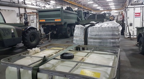
Mounts Bay is equipped with a dedicated Humanitarian and Disaster Relief (HADR) team made up of personnel from the Royal Engineers and Royal Logistic Corps and is carrying vital aid and specialist equipment, such as all-terrain quads, dump trucks, diggers and stores. The ship is also able to provide essential medical care. It is understood that the ship has the capability to transport up to 3600 evacuees (in ideal conditions) to nearby islands.
IEC Telecom’s new partnership with Lars Thrane
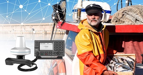
It was reported from Ålesund, Norway, on 2 September that satellite communications specialist IEC Telecom has extended its portfolio through a partnership with specialist satcoms manufacturer Lars Thrane.
IEC Telecom is now an official distributor of the LT-3100 Iridium satellite phone in Norway and went to unveil its new product range during the major shipping industry BlueFish held in A?lesund from 3 to 5 September.
RAF Typhoons complete NATO air policing mission in Estonia
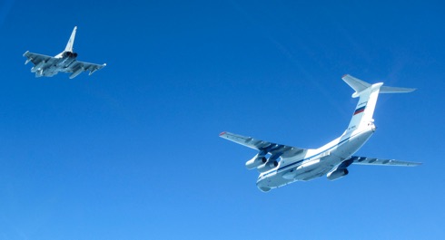
It was reported on 2 September by the Ministry of Defence that Royal Air Force Typhoon jets had returned to their Lincolnshire base after completing the NATO Baltic Air Policing mission and handing over to Gripen aircraft from the Czech Air Force.
Over the four-month deployment, known as Operation Azotize, RAF Typhoons conducted a total of 21 interceptions of 56 Russian aircraft in the skies above Estonia.
HMS Queen Elizabeth sails for US
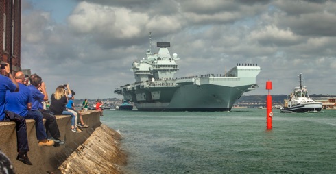
HMS Queen Elizabeth sailed from her homeport of Portsmouth on 30 August ahead of testing the UK’s F-35B Lightning fast fighter jets for the first time.
The Royal Navy’s biggest warship will be working with up to seven British F-35B jets during her Exercise Westlant 19 deployment, which sees her once again return to the east coast of North America.
This deployment marks another significant milestone for the aircraft carrier, which will have Royal Navy and RAF jets embarked during five weeks of testing, as well as hosting F-35s from the United States Marine Corps.