A New Year message from Yasuo Arai, President of IAIN
Last year I began my message by commenting on the proliferation of autonomous marine systems. That proliferation has continued apace. To date they have been mostly small craft pre-programmed for scientific research but aspirations are growing and so is the size of vessels intended to be remotely controlled or, indeed, autonomous. IAIN is engaging in this area, most specifically by supporting the UK Marine Autonomous Systems (MAS) Regulatory Working Group to evolve a regulatory framework that will enable developers to plan their projects so as to be compliant with those regulations.
Despite activity in the US intended to encourage industry to develop a suitable non-space-based timing and positioning system to complement GNSS and the evident deliberate and significant interference to GNSS signals in some parts of the world, there does not yet seem to be a commercially viable system available for consideration. With the advent of more, and larger, MAS the necessity for a reliable timing and navigation backup to space-based positioning is evermore starkly obvious. The only system presently developed enough that it could deliver a solution to this requirement is e-LORAN. For the users, the elegant way to encompass eLORAN would be to develop a multi-system receiver capable of processing signals from some or all of the major GNSS (GPS, GALILEO, GLONASS, COMPASS) and the Regional Navigation Satellite Systems (QZSS, IRNS (or NAVIC)) and eLORAN, for they all use similar correlation techniques and they are each suitable for land, sea and air platforms.
We wish a happy, successful and safe New Year to all our Members and readers.
 Yasuo Arai,
(Japan Institute of Navigation)
IAIN President
ENC 2017 – latest news
The local organising committee of ENC2017 is progressing well with the preparation of the scientific programme for this event to be held in Lausanne from 9-12 May next. With the launch of the Galileo initial services and the evolution of the GNSS programmes the conference will have an exciting opening session and panel discussion on GNSS, it is understood.
Please note: The deadline for submitting a paper to ENC 2017 has been extended to 24 January, see the submission details for authors and the Call for Papers.
Dedicated sessions may be included in the programme, typically those associated with European Projects. Those with interests here are invited to contact Pierre-Yves Gilliéron directly at: pierre-yves.gillieron _ at _ epfl.ch.
UK Parliament Transport Select Committee’s new inquiry
![]()
In the UK’s House of Commons, the Transport Committee announced it is launching a new inquiry into industry and government action in response to Maritime Growth Study, a report on the UK’s maritime sector, published by the Department for Transport in September 2015.
This report was the culmination of an in-depth study of the whole UK maritime sector: shipping and ports, and the range of associated business services. It set out a number of recommendations designed to ensure the UK maintains its status as a world-leading maritime centre, and can take advantage of opportunities for global growth.
It was therefore announced that the Transport Committee intends to monitor progress towards implementation of the study’s recommendations, and consider the adequacy of the overall strategy for the UK maritime sector, including in the context of the UK leaving the European Union.
Manchester and Hyderabad airports become carbon neutral
– Manchester Airport becomes the first carbon neutral airport in the UK;
– Hyderabad Airport becomes second carbon neutral airport in India and wider Asia-Pacific region;
– 37% of air passengers worldwide now travel through airports certified under the four levels of the Airport Carbon Accreditation programme.
Hot on the heels of the recent COP22 climate negotiations there have been announcement of two airports becoming carbon neutral: Manchester Airport and Hyderabad Rajiv Gandhi International Airport. Both have now achieved carbon neutral status (Level 3+), certified by the independent carbon management programme known as Airport Carbon Accreditation.
This brings the total number of carbon neutral airports around the world to 27, while the overall programme now counts 176 airports across the four available levels of certification.
The Airport Carbon Accreditation programme – launched by the airport association ACI EUROPE in 2009 – certifies airports at four different levels of accreditation covering all stages of carbon management (i) Mapping; (ii) Reduction; (iii) Optimisation and (iv) + Neutrality). It is independently administered and has the support of the United Nations Framework Convention on Climate Change (UNFCCC), United Nation Environment Programme (UNEP), the International Civil Aviation Organisation (ICAO), the European Union (EU) and others.
Advice on drones – introducing the EASA
Popularly known as drones, but also referred to as remotely piloted aircraft systems (RPAS) or unmanned aerial vehicles (UAV) they come in a variety of shapes and sizes, ranging from small handheld types up to large aircraft, potentially a similar size to airliners.
Just like any other aircraft, an unmanned aircraft must always be flown in a safe manner, both with respect to other aircraft in the air and also to people and properties on the ground. In the UK it is the primary aim of the Civil Aviation Authority (CAA) to enable the full and safe integration of all UAS operations into the UK’s total aviation system.
Guidance for keeping drone flight safe and legal, including flying drones for fun (on non-commercial flights), is to be found here.
Introducing the EASA, the European Aviation Safety Agency
EASA’s mission is to ensure both the highest common level of safety protection for EU citizens and the highest common level of environmental protection. This is achieved with a single regulatory and certification process among Member States which, in turn, facilitates the internal aviation single market in order to create a level playing field. At the same time the Agency works with other international aviation organisations and regulators.
Tasks of EASA include the drafting of rules in all fields pertinent to the EASA mission. Furthermore, the Agency certifies and approves products and organisations in fields where EASA has exclusive competence, for example in airworthiness.
EASA’s Geo-Limitation Task Force Report can be found here.
EUROCONTROL highlights of 2016
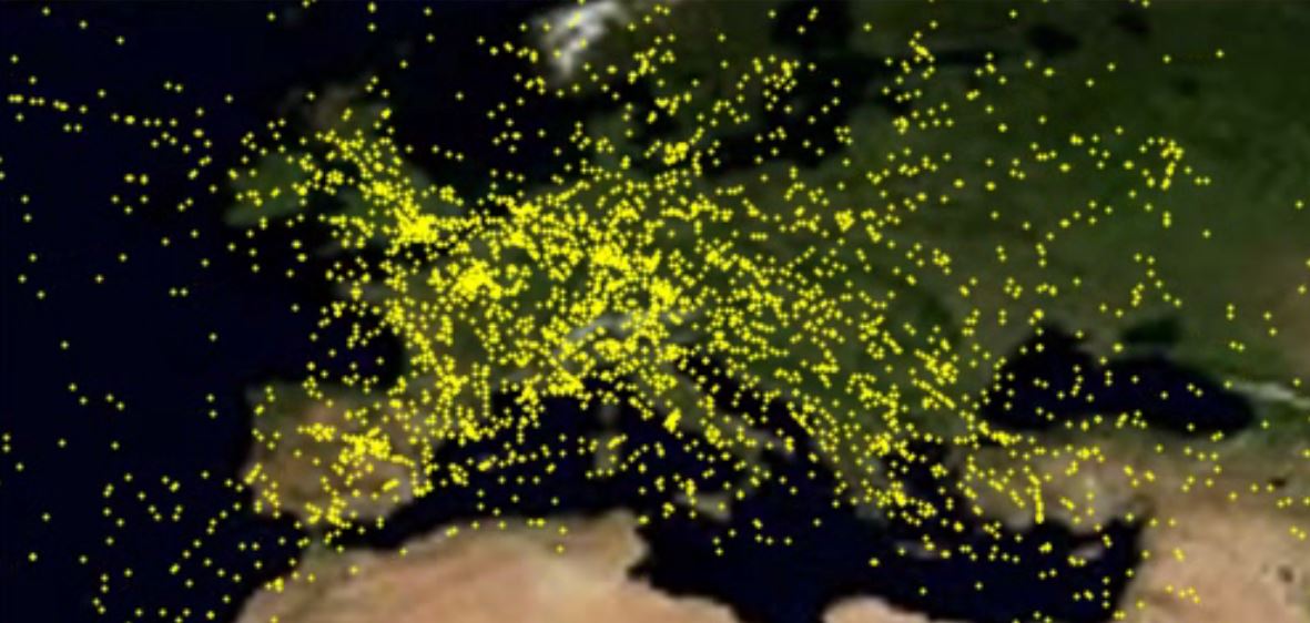
The EUROCONTROL Network Manager covers the whole of Europe – from Ireland to Armenia and from Morocco to Finland. It handles over ten million flights a year with summer peaks of over 34,000 a day. That means an aircraft is taking off or entering European airspace every three seconds. Inevitably, there are bottlenecks. These may be in particularly busy parts of airspace or at some airports at some times of day. Any disruption, such as a runway out of action, fog, a thunderstorm or technical failure, can result in difficulties.
The Network Manager receives flight plans for all the commercial flights in its area and also receives the declared capacity limits for air traffic control centres and airports across the continent. So for example if an airport has snow or fog, it may reduce the rate at which aircraft can land. This is called a regulation. The Network Manager then looks at the whole picture and problem areas are identified – where the demand is greater than the capacity.
One solution of course is to see if the capacity can be increased. So if a controller is covering a large area and the traffic is expected to be at the limit of how many aircraft can safely be handled at a single controller position, then that area might be split into two sectors, with two controllers or teams of controllers each covering part of the traffic.
Readers are invited to take a look at a review of EUROCONTROL’s highlights of 2016.
Galileo delivers globally
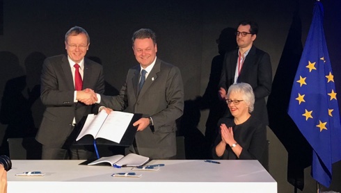
Early in December the European Space Agency (ESA) announced that Europe’s own Galileo satellite navigation system had begun operating, with the satellites delivering positioning, navigation and timing information to users around the globe.
On 9 December the European Commission, owner of the system, formally announced the start of Galileo Initial Services, the first step towards full operational capability. Further launches will continue to build the satellite constellation, which will gradually improve the system performance and availability worldwide.
Satellite trials in Euro ATC
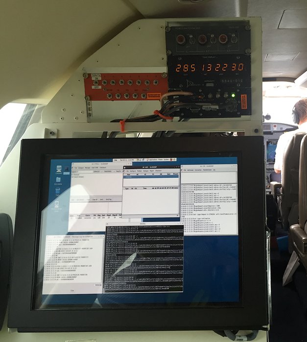
It was announced on 20 December that the European Space Agency (ESA) had recently completed its first flight trials using satellites to help bring Europe closer to its goal of modernising air traffic control. These trials are part of the public-private partnership between ESA and UK satellite operator INMARSAT to deliver high-capacity secure digital data links via satellite for air-ground communications for cockpit crews over European airspace under ESA’s Iris Precursor programme.
It is understood that by 2019, Iris Precursor will provide air-ground communications for initial 4D flight path control, pinpointing an aircraft in four dimensions: latitude, longitude, altitude and time. This will enable precise tracking of flights and more efficient management of traffic.
Think Climate Coalition international conference
Climate change is an important and growing focus of attention. The Paris Agreement on climate change, which came into force on 4 November 2016, is an ambitious international agreement that aims to combat climate change and adapt to its effects. Coming years are likely to see massive efforts to reduce greenhouse gas emissions and move to low carbon solutions across all sectors: navigation infrastructure is no exception. Notwithstanding the Paris Agreement, however, it is also widely agreed that continuing change in certain climate parameters is now unavoidable. Resilience will need to be strengthened and waterborne transport infrastructure will need to adapt.
The PIANC-led Think Climate Coalition announced on 20 December a major international climate change conference dedicated to the interests of waterborne transport infrastructure owners, operators and users. The event will take place at the Crowne Plaza Hotel in Brussels, Belgium on 27/28 March, 2017.
ICAO on UAS’s (drones)

Aimed at assisting consumers and remote pilots regardless of their skills and experience, the ICAO launched from its Montréal HQ on 13 December its new Unmanned Aircraft Systems (UAS) Toolkit on the occasion of International Civil Aviation Day.
Commented ICAO Council President Dr Olumuyiwa Benard Aliu: ‘The resources this new toolkit makes available are designed to help UAS operators of all ages operate their aircraft safely and responsibly. The importance of recognizing that these devices are aircraft, and of integrating their use safely with existing manned operations, should not be underestimated.’
Given that UAS, informally referred to as drones, can be mistakenly and often illegally operated by less-informed pilots around airports and other areas of controlled or sensitive airspace, ICAO has been taking steps to help minimize their risks. Its new UAS Toolkit is much more than a starting point for learning
the basics of their safe operation.
Maritime Safety Committee, 97th meeting
The 97th session of the IMO Maritime Safety Committee (MSC) was held at
IMO HQ in London from 21-25 November.
Among other issues, these recommendations stand out:
– The MSC adopted recommendations on the safe carriage of more than 12 industrial personnel on board vessels engaged on international voyages, aimed at addressing the safe and efficient transfer of technicians at sea, such as those working in the growing offshore alternative energy sector.
– Also adopted were recommendations for carriage of liquefied hydrogen in bulk, as the International Gas Carrier (IGC) Code lacks specific hydrogen requirements.
– Subject to IMO Assembly confirmation, the MSC adopted amendments on a recommendation to Governments to take into account safety of navigation when multiple structures at sea, such as wind turbines, are being planned.
– Amendments were approved to update the International SafetyNET and the
NAVTEX Manuals. SafetyNET is the international automatic direct-printing satellite-based service for the promulgation of Maritime Safety Information (MSI), navigational and meteorological warnings and forecasts and other urgent safety related messages to ships, including SAR information. NAVTEX provides coastal shipping, via terrestrial means, with similar messages above by automatic display or printout from a dedicated receiver.
– The MSC approved a circular expressing grave concern over the reported
launch of missiles by the Democratic People’s Republic of Korea without due warnings.
Report on the eleventh ICG meeting
The Eleventh Meeting of the International Committee on GNSS (ICG) was held in Sochi, Russian Federation from 06 to 11 November 2016.
“I took part in the last two ICG meetings and I can say that all ‘owners’ of satellite systems are having small problems with implementation of their plans for development and modernisation. Most of these problems are related to the slowdown in the development of systems and the lack of possibilities to accelerate the work. The reason for this situation is the global financial situation.”
“The most important issue is the problem of protecting GNSS from spoofing and jamming. The best solution in this field, currently, is the terrestrial alternative generally known as ‘e-Loran’ that is in development in a few countries around the world.”
CERGAL 2017
The major milestones on the road to the successful operational rollout of Satellite Navigation systems like GPS/EGNOS, Galileo, GLONASS and Compass (Beidou) are the qualification and certification of mission and safety critical applications.
The German Institute of Navigation DGON is offering an international symposium on certification of GNSS systems and services.
CERGAL 2017 will be held on 5-6 July 2017 at the European Space Operations Centre, Darmstadt, Germany.
For abstract submission and all details see dgon-cergal.org.
Navigation assessments – a guide to best preactice
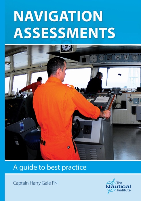
Many maritime incidents could have been prevented by the use of a navigation assessment. The way that an assessment should be conducted to the best advantage of ship operator and crew alike is the subject of a new book published by The Nautical Institute.
Navigation Assessments: A Guide to best practice explains how an assessment conducted in a positive and constructive way can provide tangible benefits for maritime safety while contributing to the professional development of bridge team members.
The use of the term ‘assessment’ rather than ‘audit’ is intended to emphasise the positive and to encourage crews to be truthful with assessors. An assessment should be conducted over several days at sea so that the assessor can gain an understanding of the culture on board and identify the navigation team members’ strengths and weaknesses. Coaching, consultation and feedback between assessor and bridge team can break down barriers and build stronger safety cultures.
EfficienSea2 mid-term conference report
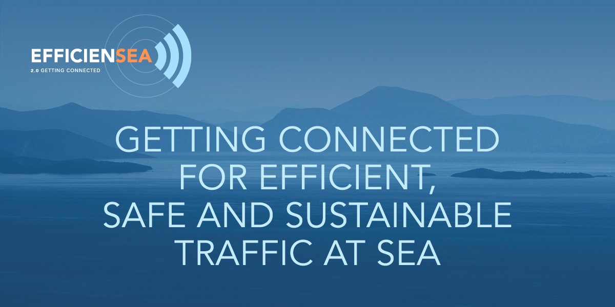
EfficienSea 2 is an three-year EU Horizon 2020 funded project led by the Danish Maritime Authority (DMA), with 32 partners. Its mid-term conference was held in Copenhagen on 8 and 9 November 2016, aiming to give both industry and other actors outside the project a chance to become familiar with and give feedback on the e-Navigation solutions being developed by EfficienSea2.
‘Safe connectivity made easy’ were the defining words of the conference. Two platforms – the Maritime Cloud and the BalticWeb – were released in BETA
versions and demonstrated with a number of services.
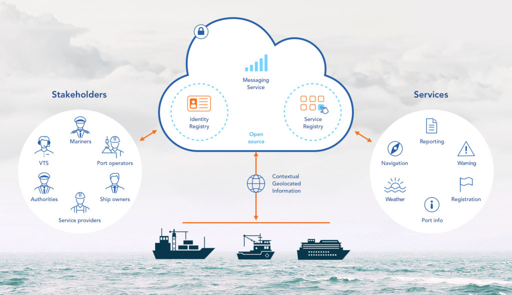
The Maritime Cloud was the first thing to be demonstrated at the conference. Consisting of a service registry, an identity registry and a management portal, the Maritime Cloud will make it possible to connect the end user of services with the service providers in a way which is both user friendly and safe.
The BalticWeb was introduced as a platform for e-navigation services. Demonstrations were given of harmonized, digital navigation services, including real-time chart updates, navigational warnings and notices to mariners. Smart wayfinding using data overlays was presented, with optimized routeing on the Baltic Web, using weather and ice prognosis as a way of finding efficient routes, as well as space weather prediction for more accurate navigation. Sea/shore integration was demonstrated, with route sharing ship-to-shore and information sharing between Vessel Traffic Services/Ship reporting Systems (VTS/SRS) for efficient SAR operations.
MLA College wins Gold Award
It was reported on 1 December that Marine Learning Alliamce College had won the Gold award for the Best Online Distance Learning Programme at the Learning Technologies Awards 2016 in London on 30 November for their submission: Delivering degrees to seafarers without internet.
The panel of independent academics judging the submission were impressed with the way MLA College combined innovative technology with traditional academic tutoring that was personalised to each student, enabling a whole new generation of seafarers to gain a higher qualification whilst remaining in their full-time job.
The Awards gathered 800 people to celebrate the best learning technologies across the world, with shortlisted entries from Canada, Australia, New Zealand, India, USA, Turkey, Germany, Hungary, Switzerland, Spain and Italy.
Light in the darkness
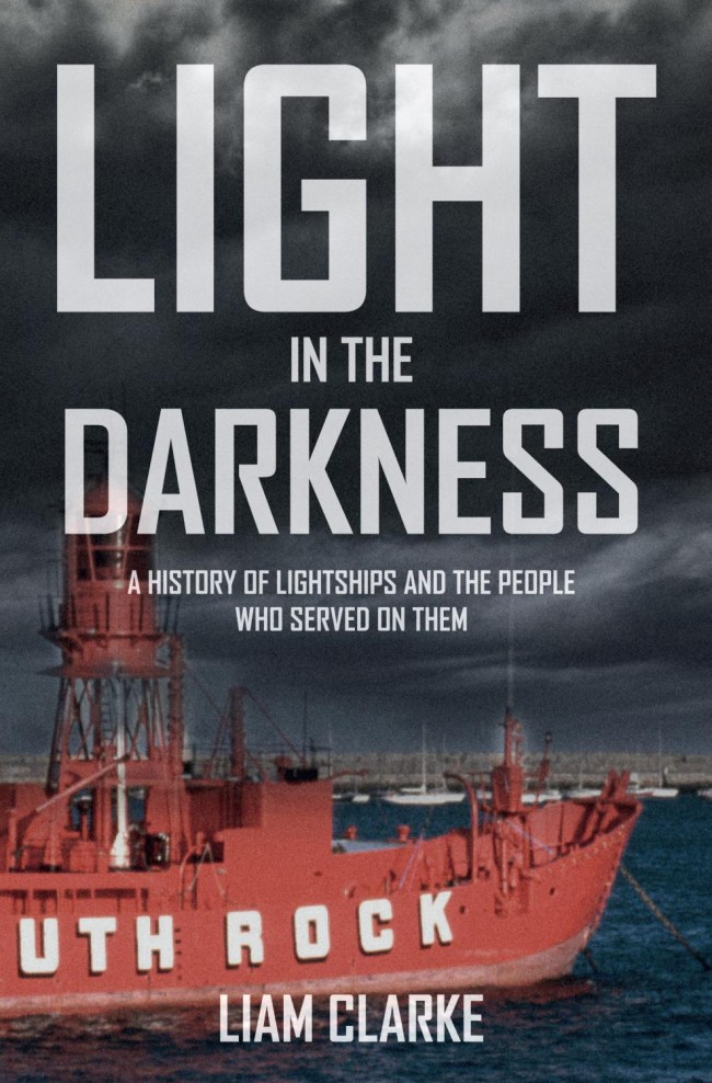
Light in the darkness: a history of lightships and the people who served on them by Liam Clarke. This 160 page paperback examines the origins of the lightship services of Great Britain and Ireland, the obstacles and prejudices that faced originators of the idea and the subsequent development of the vessels and working practices over the years.
Dr Clarke has certainly been dedicated in his extensive research and uses in many places his own illustrations.
Since Hamblin’s lightship of 1731 the dangerous occupation of lightsman has claimed the lives of a number of crews and those who tried to save them in peace and in war. The lives and working conditions of the brave men who put their lives at risk guiding ships safely to their ports without peril, has been almost forgotten although some of the ships in which they fared continue to serve the mariner in an automated state monitored from shore. Indeed, some have hulls half a century old, testament surely, to sound materials and good ship husbandry.
Orders may be placed at Amberley Publishing.
Maps and the 20th century: drawing the line

© British Library, photo by Clare Kendall.
A major new exhibition at the British Library, 4 November 2016 – 1 March 2017, looks at the history of the 20th century through its maps for the first time, shedding new light on familiar events, from global conflicts to the depths of the ocean floor – and even the mapping of outer space. It explores how 20th century maps shaped the ways we see the world we live in. Furthermore, it celebrates the rare beauty and astonishing variety of 20th century maps from the first sketch of the London Underground from 1931, to declassified Ministry of Defence maps, Ordnance Survey maps from the 1920s, a Russian moon globe and the first map of Winnie the Pooh’s Hundred Acre Wood.
From questions of war and peace, to understanding the movements of people, nature, and even the financial markets, Maps and the 20th Century: Drawing the Line explores how maps became increasingly present in 20th century lives.
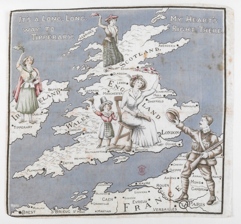
The exhibition looks at the spectacular advances in the technology of mapping across the century, from the land surveys of 1900 to the development of satellite imagery by 2000. For the first time, we could see from the Atlantic Ocean floor to the far side of the Moon. Telling the history of the 20th century in maps allows us to reconsider the recent past from different perspectives.
IMO awards for exceptional bravery at sea
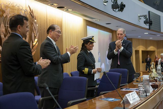
The IMO Award for Exceptional Bravery at Sea was established by IMO to provide international recognition for those who, at the risk of losing their own life, perform acts of exceptional bravery, displaying outstanding courage in attempting to save life at sea or in attempting to prevent or mitigate damage to the marine environment. For 2016, 23 nominations were received from nine Member States and one inter-governmental organization.
The Master of an Indian oil tanker who says she was “just doing her job” has received the highest IMO bravery recognition for saving the lives of seven fishermen from a sinking fishing boat during a tumultuous storm in the Bay of Bengal in June 2015.
‘It is every seafarer’s and Master’s solemn duty and obligation to save souls in distress at sea. I just did what a seafarer should do for a fellow soul in distress at sea. Yes, it was an instant decision, but not without assessing the risks involved. I just did my duty,’ said Captain Radhika Menon, Master of the oil products tanker Sampurna Swarajya.
OMC Int.-MetOcean Solutions alliance announces new products
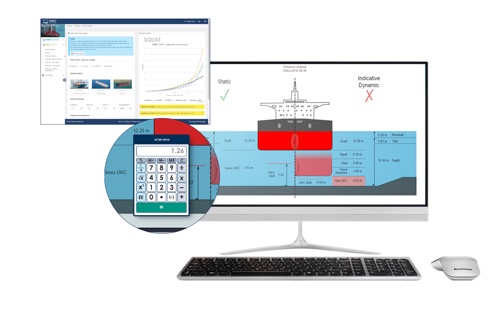
OMC International and its new alliance partner MetOcean Solutions announced on 21 November the launch of three new products to help ports and harbours manage under-keel clearance (UKC), the mooring of berthed ships, and weather-related risks.
OMC International’s CEO Peter O’Brien said: ‘These are products that we have had on the drawing board for a number of years in response to customer requests, and our alliance with MetOcean Solutions has helped provide the momentum and support to bring them to market. We are offering these products alongside our flagship DUKC® to assist a wider range of ports and harbours, both in our home markets of Australia and New Zealand as well as internationally.’
The new products are: * KeelCheck, a simple calculator which helps ports which have not made the step to DUKC® assess the safe clearance of their traditional UKC rules; * PortWeather, an integrated environmental data management system which will attach to ports’ existing sensors and provide measurements and portspecific forecast data to displays in the port and internet-connected mobile devices; and * BerthAlert, a comprehensive forecasting and monitoring solution for berthed ships.
More detail and the opportunity for free trial accounts on OMC’s site.
ASV landmark: 1,000 days of operations
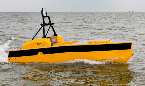
Recent weeks have seen a report from ASV Global, a leading manufacturer of Autonomous Surface Vehicles, that one unit has reached the landmark of 1000 days of unmanned operations. This milestone was reached during the Unmanned Warrior 2016 naval presentation which saw more than 50 unmanned vehicles operating in a variety of themed activities. With this the Royal Navy was able to see first-hand how these types of systems and sensors could integrate into current and future operations.
A number of ASV Global developed vehicles and systems participated in the event including converted vessels such as BAE Systems’ Pacific 950 and Pacific 24 RIBs and Dstl’s Maritime Autonomy Surface Testbed (MAST) based on the innovative Bladerunner hull shape. The event also showcased vehicles designed and built by ASV Global including the commercial vehicle C-Worker 5 (illustrated) and the Thales’ mine countermeasures demonstrator platform known as Halcyon.
Dan Hook, Managing Director of ASV Global commented: ‘Completing 1000 days of unmanned operations during Unmanned Warrior, the world’s first large scale demonstration of maritime autonomous systems, could not have been more timely. This exemplifies the increasing speed of adoption of ASV technology and is a real testament to all of the hard work and dedication from the team.’
NTSB safety alert on midair collisions
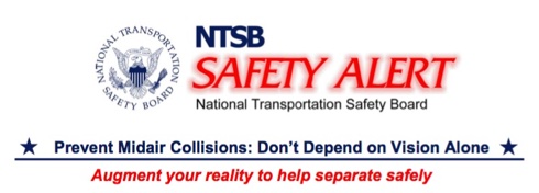
On 16 November the National Transportation Safety Board (NTSB) issued a Safety Alert to pilots with suggestions on what they can do to reduce their chances of being involved in a midair collision.
In an effort to illustrate the limitations of the “see and avoid” concept of aircraft separation, the NTSB created a series of animations, available on YouTube and a presentation, depicting the pilots’ visual field of view from each of the four airplanes involved in two midair collisions that were investigated by the NTSB in 2015. The animations show how difficult it can be for pilots to spot converging aircraft that may present a midair collision risk in a dynamic visual environment.
Further information available here
Cosmic flash shows

A brilliant flash of radio waves from the distant universe has given a unique glimpse of the gas that lies between galaxies. The flash was captured and analysed by a mostly Australian team, using CSIRO’s Parkes telescope and the results were published in the journal Science today.
‘This flash lasted just a third of a millisecond, making it one of the briefest we have seen,’ said research team co-leader Dr Ryan Shannon of CSIRO, the International Research Centre for Radio Astronomy Research (ICRAR) and Curtin University.
Called fast radio bursts, or FRBs, such cosmic flashes were discovered with the Parkes ‘scope in 2007. Just 18 have been spotted to date, most with the Parkes. Astronomers think that between 2,000 and 10,000 go off all over the sky every day but their cause is unknown. Coming from a small patch of sky containing only distant galaxies, the flash in question, FRB 150807, is believed to have originated more than a billion light-years away, according to CSIRO in a statement of 18 November.
Red Arrows China finale
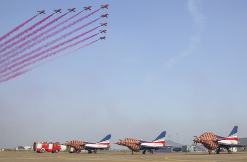
The Royal Air Force Aerobatic Team finished with a spectacular flypast involving all nine jets trailing red smoke, to draw an end to its six-day appearance at Airshow China in Zhuhai on 5 November. The displays at the event have made history, being the first time the Red Arrows have visited China and taking the number of countries in which the squadron has performed to 57 since 1965.
Squadron Leader David Montenegro, Team Leader and Red 1, said: ‘The team has flown nine public displays in China, in six days. In my time as Team Leader that is a first. China has offered a beautiful display site at Zhuhai. To fly those displays back-to-back has been a real pleasure. Every single day the weather has been great.’
The visit to China forms part of a major, 60-day tour to the Asia-Pacific and Middle East regions by the Red Arrows. It is the team’s largest overseas tour in almost a decade and is aimed at supporting and promoting UK interests across defence, industry, trade and education.
Automated Ships Ltd and Kongsberg MoU
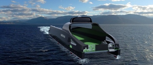
On 1 November Kongsberg of Norway announced that it had signed a Memorandum of Understanding with the UK’s Automated Ships Ltd to build the world’s first unmanned and fully-automated vessel for offshore operations. It is understood that in January 2017, Automated Ships Ltd will contract the vessel Hrönn, which will be designed and built in Norway in cooperation with Kongsberg.
Sea trials will take place in Norway’s newly designated automated vessel test bed in Trondheim fjord and will be conducted under the auspices of DNV GL and the Norwegian Maritime Authority (NMA). Hrönn will ultimately be classed and flagged, respectively it is reported.
Furthermore, Kongsberg will deliver all major marine equipment necessary for the design, construction and operation of Hrönn. This will include systems for dynamic positioning and navigation, satellite and position reference, marine automation and communication. All the vessel’s control systems including dynamic positioning, automation and ECDIS will be replicated at an Onshore Control Centre, allowing full remote operations of Hrönn.