US Navy releases collision report

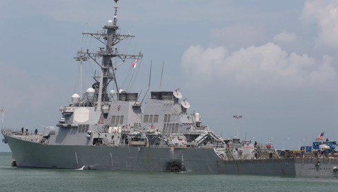
On 1 November the US Navy released a report detailing the events and actions that led to the collision of USS Fitzgerald (DDG 62) and ACX Crystal off the coast of Japan on 17 June and the collision of USS John S McCain (DDG 56) and merchant vessel Alnic MC on 21 August this year.
Chief of Naval Operations (CNO) Admiral John Richardson said: ‘Both of these accidents were preventable and the respective investigations found multiple failures by watch standers that contributed to the incidents. We must do better.’
The collision between Fitzgerald and Crystal was avoidable and resulted from an accumulation of smaller errors over time, ultimately resulting in a lack of adherence to sound navigational practices.
The collision between John S McCain and Alnic MC was also avoidable and resulted primarily from complacency, over-confidence and lack of procedural compliance.
HMS Queen Elizabeth sea trials
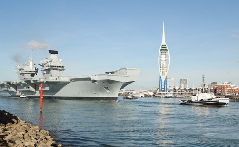
On 30 October HMS Queen Elizabeth sailed from Portsmouth Naval Base for the first time since arriving at her home port in August. The Royal Navy’s future flagship has embarked on the next set of sea trials to test her capability.
Captain of Portsmouth Naval Base, Captain Bill Oliphant said: ‘HMS Queen Elizabeth has been in Portsmouth Naval Base for two months of planned maintenance to allow her to sail to complete her sea trials today (30 October). This period at sea will mark an extremely significant milestone in the life of the ship leading towards her acceptance into the Royal Navy at her commissioning later this year, back in her home port of Portsmouth.’
IMO on enhancing fishing vessel safety
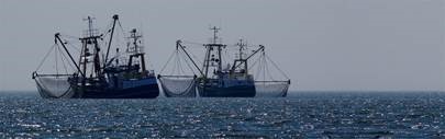
When it comes to fishing vessel safety, the mission is clear, says Sandra Allnutt of the IMO: enhance safety to save lives. Ms Allnutt, Head of Maritime Technology in IMO’s Maritime Safety Division commented: ‘We want to reduce loss of life in one of the most dangerous professions in the world, and we want to enhance safety on board fishing vessels.’
She was speaking following a regional seminar in Cape Town to promote ratification and implementation of a key fishing vessel safety treaty known as the Cape Town Agreement of 2012. She added: ‘This Agreement, once fully ratified, in force and implemented, will be an internationally binding agreement which will facilitate better control of fishing vessel safety by flag, port and coastal States. It will also contribute to the fight against illegal, unregulated and unreported (IUU) fishing.’
Danelec Marine VDRs for Indian Government vessels
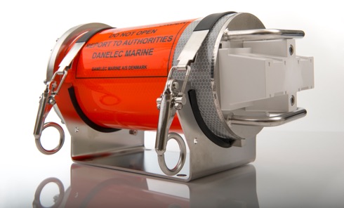
It was announced from Birkeroed, Denmark, on 25 October that maritime technology company Danelec Marine had engaged in a new partnership with the government of India. The deal, struck by a Danelec local distributor, is the first Indian government contract for the company. The deal entails fitting out newly-built ships with Voyage Data Recorders or VDRs (see illustration), including 12 Indian Coast Guard patrol boats, and retrofitting in six Indian Navy frigates. With production beginning in 2018 to be completed by 2019, the contract paves the way for future partnerships and a continued presence in the region.
A statement from the Secretary-General of IMO

Recent media reports have questioned the transparent, inclusive approach adopted by all stakeholders with an interest in addressing the threat of climate change through the IMO, the global regulator of shipping, and the body most able to deliver uniform, global solutions in the spirit of the 2015 Paris Agreement. Indeed, IMO’s efforts to reduce harmful air emissions from ships spans decades, and continues this week with the second meeting of the Intersessional Working Group on Reduction of GHG Emissions from Ships. 57 IMO Member States and 21 Non-governmental organizations (NGOs) in consultative status are participating in this week’s meeting.
As is the case in other UN agencies of a technical nature, the make-up of national delegations to IMO is entirely a matter for the countries themselves, and those countries who wish to include industry technical experts or others may do so. Neither the IMO Convention, nor any of the Rules of Procedure for individual meetings limits, in any way, Member States’ ability to structure their delegations as they consider most appropriate in order to carefully onsider the issues before them.
VSTEP to provide UAE bridge simulators
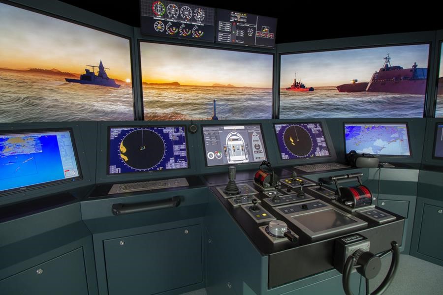
It was announced from The Netherlands on 24 October that the Rotterdam based VSTEP has been awarded a contract from CAE to provide a suite of custom-built ship bridge simulators for the United Arab Emirates’ (UAE) Naval Training Centre (see illustration).
VSTEP was selected to provide the Full Mission Bridge Simulators after an extensive evaluation process. The visual quality, the hydrodynamic fidelity and extendibility of VSTEP’s new NAUTIS 3 simulation platform were important criteria. Some of the bridge simulators will be reconfigurable for the different vessels of the UAE Navy to allow for vessel-specific training capabilities.
First Galileo user assembly

One year after the launch of Galileo Initial Services, the 1st Annual User Assembly will take place in Madrid on 28-29 November. Spread over two days the Assembly will include four fora: Transport, Mass Market, Professional and R&D – with the theme User Consultation Platforms, giving European GNSS users the opportunity to discuss their needs and experiences and provide feedback on Galileo performance.
The 1st Galileo User Assembly will also provide:
– An update on the Galileo programme;
– Presentations on Galileo Initial Services performance, the Galileo Services Roadmap and the Galileo User Interfaces;
– Opportunity to participate in the Galileo User Satisfaction Survey.
Participants will also have the opportunity to take part in the networking reception and tour the premises of the European GNSS Service Centre (GSC).
Take a look at the program.
Standing by to launch two more Galilieo satellites
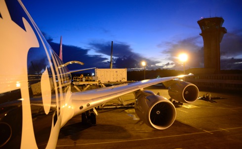
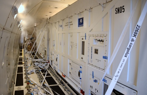
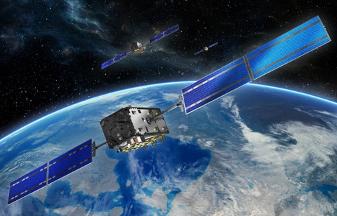
Two more Galileo satellites have reached Europe’s Spaceport in French Guiana,
joining the first pair of navigation satellites and the Ariane 5 rocket due to
launch the quartet into orbit this December. Galileos 21 and 22 left Luxembourg Airport on a Boeing 747 cargo jet on the morning of 17 October, arriving at Cayenne – Félix Eboué Airport in French Guiana the same day.
Resting within distinctive white air-conditioned containers, the satellites were driven to the cleanroom environment of the preparation building within the space centre. Waiting for them there were Galileos 19 and 20, which arrived in September.
The four satellites will be launched together in mid-December by a customised Ariane 5, the elements of which reached French Guiana last month (September) by sea.
MAIB Report on the grounding of Muros
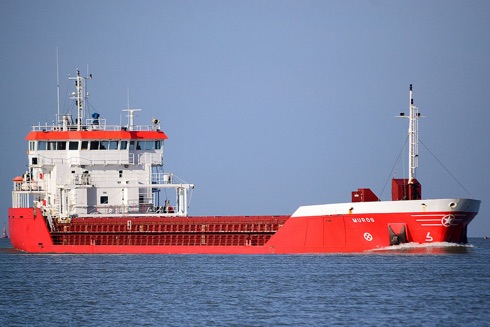
In the early hours of 3 December 2016, the bulk carrier Muros ran aground on Haisborough Sand and the Master’s attempts to manoeuvre the vessel clear were unsuccessful due to a falling tide. Damage to the rudder necessitated the vessel, refloated six days later, being towed to Rotterdam for repair.
There is increasing evidence first generation ECDIS systems were designed primarily to comply with the performance standards required by the IMO, as these systems became a mandatory requirement on ships, with insufficient attention being given to the needs of the end user. As a consequence, ECDIS systems are often not intuitive to use and lack the functionality needed to accommodate accurate passage planning in confined waters, leading to seafarers using ECDIS in ways which are at variance with the instructions and guidance provided by the manufacturers and/or expected by regulators.
IEEE/ION PLANS 2018 23-26 April, 2018
The biennial PLANS conference, co-sponsored by the ION and IEEE AESS, features researchers and engineers from around the globe who present their latest work in positioning and navigation technologies. Presentations range from fundamental research, to applications, to field test results with a particular emphasis on inertial navigation. Technical sessions cover a range of subjects for both beginners and seasoned professionals.
Abstracts for the IEEE/ION Positioning, Location and Navigation Symposium (PLANS) are due Monday, 30 October 2017.
NAV CANADA reports September traffic figures

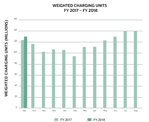
Traffic figures for the month of September 2017 were announced from Ottawa on 16 October by NAV CANADA. These monthly figures are measured in weighted charging units for en route, terminal and oceanic air navigation services, in comparison to the prior fiscal year.
Air traffic in September 2017 increased by an average of 5.4% compared to the same month in 2016. September represents the first month of NAV CANADA’s fiscal year which runs from 1 September to 31 August.
ION (US) extra workshop

The (US) Institute of Navigation informs that it will hosting a Cognizant Autonomous Systems for Safety Critical Applications Workshop on 29 January at the Hyatt Regency, Reston in Reston, Virginia.
The workshop is complementary but registration is required to attend and it is being held in coordination with the ITM/PTTI 2018 conference and in parallel with the PTTI tutorials.
African land cover as seen by satellite
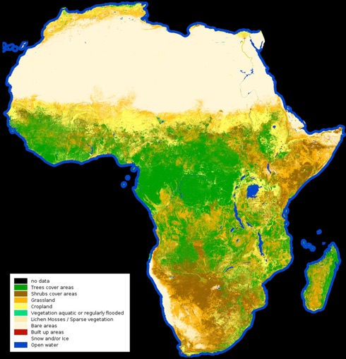
From the barren Sahara to lush jungles, the first high-resolution map classifying land cover types on the entire African continent has been released by the European Space Agency (ESA). This map was created using a year’s worth of data from the Sentinel-2A satellite and as can be seen it shows Africa’s diverse landscapes from grasslands to croplands, water bodies to deserts.
Land-cover mapping breaks down the different types of material on the Earth’s surface. This information is important for understanding changes in land use, modelling climate change extent and impacts, conserving biodiversity and managing natural resources.
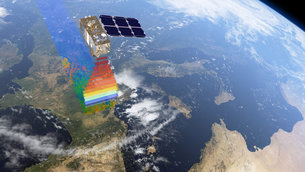
The map released early in October comprises 180,000 Sentinel-2A images representing 90 terabytes of data captured between December 2015 and December 2016. Considering the size of the map – about six gigabytes – a web interface was developed to visualise the data.
INC 2017 – Innovations in autonomous & resilient PNT

London-based Royal Institute of Navigation informs that as well as the latest technical innovations and technology updates, INC2017 will cover the legal, ethical, human cognitive and regulatory issues associated with realising new opportunities.
Presentations, an exhibition and networking at RIN INC2017 are expected to broaden knowledge and provide a range of perspectives on topics as diverse as artificial intelligence, authentication, privacy, machine learning and augmented reality in location applications. In addition, on 27 November the Resilient PNT Forum will meet in the afternoon, in partnership with RIN INC2017, following the very well attended meeting at RIN INC2016.
World’s first NINOX remote tower ATC system installed: Røst Airport, North Norway
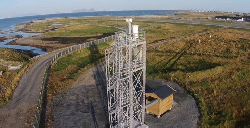
On 11 October Kongsberg reported that at Røst airport in the north of Norway, the world’s first NINOX remote tower air traffic control system has been installed and begun testing.
The NINOX remote towers programme is said to be the world’s largest remote tower programme with more than 15 airports designated for Remote Tower Systems. The illustration here shows the structures as installed.
Following the announcement in 2015 of Norwegian airport operator Avinor‘s agreement with KONGSBERG and Indra Navia to develop and install the world’s largest remotely operated air traffic control system, the first system has now been installed and is under test. Installation and approval of the next 14 airports will be accomplished through to 2020, it is understood.
Hamburg Pilots’ Choir annual concert
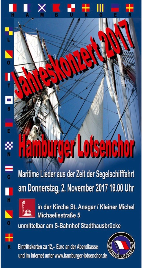
According to Captain Dieter Wulf, the Hamburg Pilots’ Choir will perform their Annual concert in St Ansgar’s Church / Kleiner Michel in Michaelisstrasse 5, Hamburg (S-Bahnhof Stadhausbrucke) on Thursday 2 November 2017 at 1900.
It is understood that tickets cost € 12,00.
ION ITM PTTI – a reminder

The deadline for submitting abstracts for the ION co-located International Technical Meeting (ITM) and the Precise Time and Time Interval (PTTI) Systems and Applications Meeting is Tuesday 10 October, 2017. Abstracts may be submitted online for the ION ITM/PTTI 2018 conference that will take place 29 January – 1 February, 2018 at the Hyatt Regency Reston, Reston, Virginia.
The Navigator #16
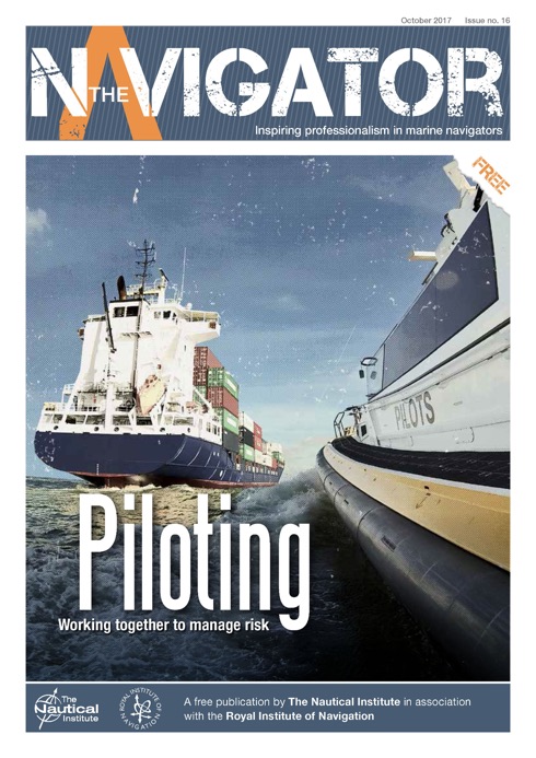
Pilots and their relationship with bridge teams is the focus of the latest edition of The Navigator, the magazine available for free to all seafarers from The Nautical Institute.
Issue 16 examines how best to support a pilot’s skills when they come on board a vessel and how to maintain an excellent relationship with them, both during and after their manoeuvres into and within the port.
Emma Ward, Editor of The Navigator, said: ‘The relationship between pilots and bridge teams is unique. It relies on teamwork, co-operation and smart risk assessment skills on both sides. Being able to share best practice and discuss the opportunities and challenges surrounding pilotage is crucial, which is why we have concentrated on the topic for this issue of The Navigator.’
Welcome to NAV Canada

At IAIN we welcome NAV CANADA to Associate Membership and look forward to carrying their news from time to time. May their stay be long and fruitful.
NAV CANADA, the country’s civil air navigation services provider, is a private sector, non-share capital corporation financed through publicly-traded debt. Furthermore, it is the company that owns and operates Canada’s civil air navigation service (ANS). It manages 18 million square kilometres of Canadian and oceanic airspace. With 40,000 customers and 12 million aircraft movements a year NAV CANADA is the world’s second-largest air navigation service by traffic volume.
Latest Galileo delivery


Europe’s next two Galileo navigation satellites have been delivered to Europe’s Spaceport in French Guiana ahead of the launch of a quartet by Ariane 5 at the end of this year. Galileos 19 and 20 left Luxembourg Airport in a Boeing 747 cargo jet on the morning of 18 September, arriving at Cayenne – Félix Eboué Airport in French Guiana that evening. Safely cocooned within protective air-conditioned containers, the pair were offloaded and driven to the cleanroom environment of the preparation building within the space centre. This building will remain their home as preparations for their launch proceeds, with the next two Galileos due to join them later this month (October).
2017 (US) Institute of Navigation Kepler Award Professor Terry Moore FRIN
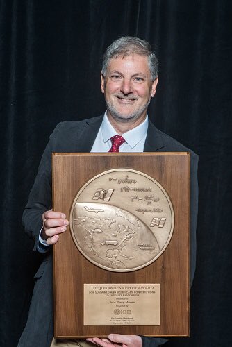
We send our congratulations to Professor Terry Moore, FRIN, of Nottingham University (Vice-President of the (UK) Royal Institute of Navigation on winning the ION Kepler Award for significant contributions to navigation.
The full citation reads: ‘In recognition of his outstanding contributions to the development of satellite navigation through a sustained and distinguished professional career devoted to research and teaching.’
Professor Terry Moore has over 30 years of research experience in surveying, positioning and navigation technologies, and is a consultant and advisor to UK and European government organisations and industry. He has taken a leading role in national and European initiatives aimed at integrating academic research and teaching activities in GNSS and interacting closely with industry.
Exercise Dynamic Monarch concludes
It was reported by NATO from Marmaris Naval Base in Turkey on 22 September that the NATO-led submarine Exercise Dynamic Monarch was concluded that day following two weeks of multi-national training and practice in Submarine Escape and Rescue (SMER) procedures. Centred around the International Submarine Escape and Rescue Liaison Office (ISMERLO), an organization created in the wake of the Kursk tragedy as an international hub for information and coordination on submarine rescue, this exercise had been designed to demonstrate multi-national submarine rescue cooperation and interoperability as well as to share SMER-related knowledge amongst worldwide partners.
Nine NATO Allies participated in the exercise this year with equipment or personnel being provided by Canada, France, Italy, Norway, Poland, Spain, Turkey, the United Kingdom and the United States. In addition, observers from Bangladesh, Indonesia, Japan, Pakistan, Poland, Spain, South Korea, Sweden and the United Kingdom took part in various portions of the exercise.
The 8th International e-Navigation Underway Conference 2018
The International e-Navigation Underway Conference is a global destination for discussion and debate about the many different challenges facing e-Navigation around the globe, both in its sessions and in the range of networking opportunities it affords. Featuring some of the top maritime leaders in their fields and covering a wide breadth of topics, the Conference is the place in which to explore new strategies and to chart future technological progress.
Following the successful formula of previous years, The 8th International e-Navigation Underway Conference departs from Copenhagen on 24 January 2018 in mv Pearl Seaways.
To take advantage of the Early Bird Discount of 10% readers are invited to book before 15 November 2017.
This event is organised by the Danish Maritime Authority and IALA with the support of IHO, BIMCO, NI and CIRM.
Sites to watch #5
Much of the world depends upon satellite systems for precise navigation and timing services. These are exceptionally accurate and dependable, yet jamming, spoofing, and other forms of interference appear to be growing in frequency and severity. Neither are space systems immune to severe space weather or cyber-attack. This has the potential for devastating effects on our lives and economic activity.
There has been an opportunity to stay the destruction of Loran-C antennae in Europe thus retaining the back up to GPS in the event of failure or interference with transmissions.
See the website of the Resilient Navigation and Timing Foundation, particularly the news page with reports of activities in Norway.
OMC’s DUKC® technology taught at Melbourne U.
Case study examples of OMC International’s DUKC® technology are being taught for the first time at the University of Melbourne as part of a continuing partnership that recognises OMC’s expertise as a world leader in real-time Under Keel Clearance (UKC) management. University of Melbourne’s Ocean Engineering Professor Alexander Babanin said DUKC® content is being taught as part of an intensive week-long postgraduate port engineering unit developed with the support of Ports Australia and input from the maritime industry.
Professor Babanin said ‘Under Keel Clearance is the single most important issue of shipping in ports, channels and shallow areas, which is not taught in standard engineering programs at universities and so it is a must for this port engineering course. DUKC® is state of the art and we are lucky to have OMC International in Melbourne who help us to teach this specific application.’