Report from the 96th session of IMO Maritime Safety Committee

IMO has kindly issued a briefing on the 96th session of the MSC, held 11-20 May, 2016, covering a wide range of topics, among which: the verification of construction rules as conforming to goal-based standards, the adoption of SOLAS amendments (survival craft safety), container weights, cyber security, recognition of Galileo, the adoption of ships routeing systems, approval of the requirements for training for polar waters and passenger ship emergency training.
The art of bathymetry
According to Hydro International’s current newsfeed of 23 May 10% to 15% of the ocean floor has been mapped at resolutions of 100-metre pixel size or better and the vast majority of this mapped area is within territorial waters. One way to significantly increase seafloor coverage is to outsource data collection to nonhydrographic vessels or ships of opportunity, it is understood.
See Hydro International’s newsletter for more information.
Resilient PNT – if not eLoran, then what?
It is generally agreed that Resilient PNT (Positioning, Navigation & Timing) is
essential for the maritime sector. E-navigation and newer developments, such as
sea traffic management and autonomous ships will not be viable in the longterm,
without totally dependable positioning and communications. However,
there is little consensus on how to achieve resilience. eLoran has been
demonstrated as an effective terrestrial complement to GNSS, but some
European countries have now turned off their Loran transmitting stations, which
are essential to the future provision of eLoran.

Baltic air policing
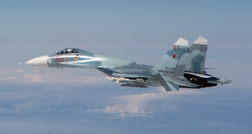
Our picture here kindly provided by the (UK) Ministry of Defence shows a Russian Su-27 Flanker intercepted by the Royal Air Force within NATO’s area of interest near Estonia on 17 May 2016.
Royal Air Force Typhoons stationed in Estonia as part of the NATO Baltic Air Policing mission have scrambled for the second time during their current deployment to intercept Russian aircraft in NATO’s area of interest. The Typhoons scrambled on 17 May to investigate five unresponsive Russian aircraft over international waters. The Russian aircraft – identified as four Su-27 Flanker fighters and one Coot-A communications aircraft – were not communicating with air traffic control, and did not transmit a recognised identification code.
IGNSS 2016 call for papers
![]()
The call for papers is now open for IGNSS 2016, set for 6-8 December in Sydney, Australia. Closing date for abstract submission is 4 July; and the final date for the submission of papers requiring peer review is 26 September.
The International GNSS Society (IGNSS) runs the Southeast Asian region’s premier conference on GNSS and related positioning, navigation and timing (PNT) technologies. It will bring together leaders in GNSS and PNT to examine the latest technology, present advanced research and discuss in open forums the implications for policy, market development and positioning infrastructure deployment.
e-navigation – Where is it going
By Dr Nick Ward CEng FRIN AFNI, GLA Research Director & Dr Paul Williams, CEng BSc(Hons) FRIN GLA R&RNAV, Principal
E-navigation is an IMO initiative for future, digital navigation in the maritime sector. It was conceived about ten years ago following an input to IMO’s Maritime Safety Committee from several leading maritime nations. This highlighted a clear need to equip the master of a vessel, and those responsible for the safety of shipping ashore, with modern, proven tools to make marine navigation and communications more reliable and thereby reduce errors.
Key objectives of e-Navigation include: safe and secure navigation of vessels, facilitating communications, including data exchange between vessels and shore, integration and presentation of information onboard and ashore to maximize navigation safety benefits and minimize risk of confusion, as demonstrated in projects such as Mona Lisa 2.0.
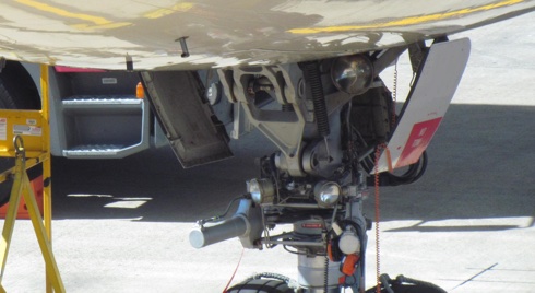
Air data system failure in Airbus A330 – ATSB report
On 6 May 2016 The Australian Transport Safety Bureau (ATSB) issued a report of its investigation into an air data system failure in an Airbus A330-243 near Brisbane, Queensland, in 2013.
On 21 November 2013, after a flight from Singapore, an Etihad Airways Airbus A330 landed at Brisbane airport and was taxied to the terminal. Approximately two hours later, the aircraft was pushed-back from the gate for the return flight to Singapore. The captain rejected the initial take-off attempt after observing an airspeed indication failure on his display. The aircraft taxied back to the terminal where troubleshooting was carried out, before being released back into service. During the second take-off roll, the crew became aware of an airspeed discrepancy after the V1 decision speed and the take-off was continued. Once airborne, the crew declared a MAYDAY and decided to return to Brisbane where an overweight landing was carried out.
Engineering inspection after the overweight landing found that the Captain’s pitot probe was almost totally obstructed by an insect nest, consistent with muddauber wasp residue. The pitot obstruction had occurred during the two hour period that the aircraft was on the ground at Brisbane and was not detected during troubleshooting after the initial rejected take-off.
Air League annual reception medals’ presentation

On the evening of 3 May The Air League held its Annual Reception at St James’s Palace, London, where a number of individuals and organisations were recognised for their remarkable achievements, with a series of awards presented by The Air League Patron HRH The Prince Philip, Duke of Edinburgh.
The Air League’s most prestigious award (very seldom presented) – The Founder’s Medal – was awarded to Major Tim Peake for his remarkable exploits in Space, noting that he was the first Briton to walk in Space.
Major Peake, who is currently circling the Earth aboard the International Space Station and due to return on 18 June, was unable to be present at the event but in a surprise phone call, listened to by the 350 guests, Tim called down and spoke to Prince Philip and The Air League Chairman Christopher Walkinshaw, thanking them for this medal in recognition of his achievement. The Founder’s Medal was accepted from Prince Philip on Tim’s behalf by his parents Nigel and Angela Peake.

First EGNOS LPV-200 approach implemented at CdG Airport
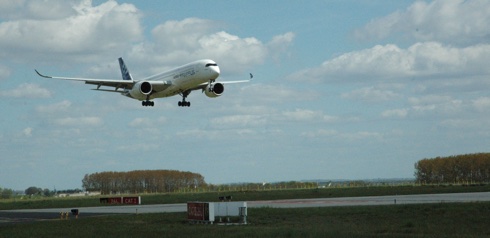
On 4 May the European GNSS Agency (GSA) announced that the first LPV-200 approaches had been implemented the previous day at Paris Charles de Gaulle Airport (LFPG) – the first such approaches to be implemented in Europe. This announcement follows the publication of the EGNOS-based procedures on 28 April.
LPV-200 enables aircraft approach procedures that are operationally equivalent to a CAT I instrument landing system (ILS) procedures. This allows for lateral and angular vertical guidance during the Final Approach Segment (FAS) without requiring visual contact with the ground until a Decision Height (DH) down to only 200 feet above the runway (LPV minima as low as 200 feet).
These EGNOS – European Geostationary Navigation Overlay Service – based approaches are considered ILS look-alike, as the LPV-200 service level is compliant with International Civil Aviation Organization (ICAO) Annex 10 Category I precision approach performance requirements, but without the need for the expensive ground infrastructure required for ILS.

Airport expansion in the south east of England
In a report published on 4 May 2016 UK Members of Parliament on the House of Commons Transport Select Committee urge the Secretary of State for Transport to set out a clear timetable for expansion, making clear the measures which have been accepted or rejected and the work which needs to be completed.
The report concludes that arguments for and against expansion have changed little in a quarter of a century. The House of Commons Select Committee continues to back Heathrow, with the package of accompanying measures recommended by the Airports Commission.
EU Commission seeks views on space strategy
On 19 April, the European Commission launched a public consultation to collect views on the objectives of the EU future space strategy, the main challenges and opportunities for the European space sector, as well as the future of EU space programmes.
Between 2014 and 2020, the EU is investing over €12bn in the implementation of the EU’s space programmes on satellite navigation (Galileo and EGNOS), Earth observation (Copernicus) and space research under Horizon 2020.
Copernicus Sentinel-1B successfully launched
![]()
On 25 April the fourth Copernicus sentinel satellite, Sentinel-1B, was successfully launched from Europe’s Spaceport in French Guiana. The 2.3 tonne unit lifted off on a Soyuz rocket that delivered the EU satellite into orbit at a height of 693km. Sentinel-1B is now orbiting the Earth, with a 180° orbital phasing difference with its twin brother, Sentinel-1A, launched two years ago.
This mission provides key data to the European Union Copernicus Programme and benefits numerous services, for example, those relating to the monitoring of Arctic sea-ice extent, routine sea-ice mapping, surveillance of the marine environment, monitoring land-surface for motion risks, enabling forest, water and soil management, and mapping to support humanitarian aid and crisis situations.
DHS S&T demonstrates precision timing technology
It was announced on 20 April in Washington that the Department of Homeland Security, Science and Technology Directorate (S&T) had conducted a successful demonstration of the Enhanced Loran (eLoran), a precision-timing technology for financial transactions at the New York Stock Exchange (NYSE).
eLoran is a low-frequency, high-power radionavigation signal that is broadcast by ground-based transmission stations, allowing the signal to penetrate through buildings and provide precision timing indoors and throughout urban environments.
6th MSP Conference date confirmed
News has been received that rescheduled dates have been promulgated for the sixth conference of the MSP stakeholder series, focusing on MSP Worldwide.
Due to various reasons, the conference has had to be slightly postponed. The conference is now confirmed to be held on 23-24 June 2016 at the University of the Azores, Ponta Delgada, Azores.
For enquiries about the event readers are invited to email.
Sites to watch #2
Of interest is the Norwegian Armed Forces Forum website to be found here, in particular this discussion on the cessation of eLoran transmission in NW Europe and its ramifications.
Reported on 16 April following the outage of several GPS satellites in January, demolition plans in respect of Norwegian Loran-C stations have been cancelled, it is understood, as national security was in danger if the same GPS error was repeated with consequent loss of PNT facilities.
CAA publishes final report from civil air display review

On 14 April the (UK) Civil Aviation Authority (CAA) published the final report from its Civil Air Display Review, confirming a series of measures aimed at making UK civil air displays even safer. This review was launched immediately after the tragic Shoreham Air Show accident in August last year (2015). It has been focused on the regulation of civil air displays as a whole.
The document builds on the measures already announced in the action report the CAA published in January this year (2016), which included enhanced risk assessments for displays and strengthening requirements for areas such as training and checks for those overseeing displays and the experience, skill and
health of display pilots. In addition to those actions, the CAA’s final report confirms further safety requirements that air show organisers and display pilots will have to meet for the 2016 air display season.
Counterfeit Admiralty products
The United Kingdom Hydrographic Office has re-issued a warning over the dangers posed to the safety of vessels, crews and cargoes by counterfeit nautical charts and publications and has produced a simple guide to help identify genuine Admiralty products.
The UK Hydrographic Office (UKHO) has recently observed an increase in the number of counterfeit versions of its Admiralty charts and publications in circulation. Counterfeit documents do not satisfy the carriage requirements of the International Convention on the Safety of Life at Sea (SOLAS), as they have not been issued officially by or on the authority of a Government, authorized hydrographic office or other relevant government institution. Their carriage may also fail to satisfy (and may be contrary to) the laws of Flag State Authorities and Port State Control, as well as increasing the safety risk for vessels, crews and cargoes. Furthermore, carriage of counterfeit documents is against the law in all countries that have signed the Berne Convention on copyright, which includes the vast majority of nations.
Anyone with suspicions over the authenticity of their Admiralty charts and publications is asked to contact the UKHO by mail.
Australian aviation short investigations bulletin

From Canberra on 13 April the Australian Transport Safety Bureau (ATSB) announced the publication of the latest Aviation Short Investigation Bulletin. Issue 47 covers a range of the ATSB’s short investigations and highlights valuable safety lessons for pilots, operators and safety managers.
Released periodically, the Bulletin provides a summary of the less-complex factual investigation reports conducted by the ATSB. The results, based on information supplied by organisations or individuals involved in the occurrence, detail the facts behind the event, as well as any safety actions undertaken. The Bulletin also highlights important Safety Messages for the broader aviation community, drawing on earlier ATSB investigations and research.
St. Helena Airport will soon be open
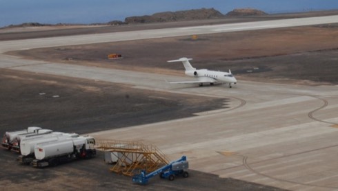
A Bombardier Challenger 300 business jet (illustrated) landed at St Helena Airport in the East Atlantic on 10 April 2016, at around 1120, the first ever jet aircraft to land at St Helena Airport (HLE). The island, a British Overseas Territory, lies 1210 miles west of Namibia, 4,000 miles east of Rio de Janeiro, Brazil.
This business jet was chartered by Air Safety Support International (ASSI) to bring its team of five personnel to St Helena to assess St Helena Airport, the construction of which had only recently been completed.
Eurocontrol’s seven year forecast
At the end of March EUROCONTROL, as Network Manager, published its latest seven year forecast for flights over Europe. The 1.5% growth that was seen in 2015 is expected to strengthen in 2016 and to reach a rate of above 2% (in the European Civil Aviation Conference, ECAC, area). Amongst the factors contributing to this is an expected increase in the demand in Iberia and Greece, leading to strong growth rates for these countries during Summer. These countries are preferred by air travellers, still staying away from North African destinations. The low-cost sector is expected to continue to be dynamic, with new aircraft for some operators. Traffic patterns in the Eastern part of Europe are still subject to changes in relation to tensions in Ukraine and the Russian Federation.
The forecast, 102 pages, is available here.
UK’s new advanced aircraft

On 7 March the (UK) Ministry of Defence (MOD) announced contracts worth £167 million to upgrade and build new facilities at RAF Marham (Norfolk, East Coast), the future home of the UK’s F-35B Lightning II squadrons.
These contracts, which will create 300 new employment opportunities, will allow for the addition of maintenance, training and logistics facilities to the air station in the East Anglian region, all of which will be dedicated to the next generation fighter aircraft.
OFCOM inviting comments on space spectrum strategy

OFCOM is the (UK) Independent Regulator and Competition Authority for the UK communications industries. Readers may wish to be aware that they are invited to comment on proposed Space Spectrum Strategy which covers the use of spectrum by the satellite and space science (including earth observation) sectors. These sectors already deliver important benefits to UK citizens and consumers, such as broadcast TV, global positioning, communications to ships and aircraft, satellite imagery and information about the UK climate.
As one can imagine there is potential for greater benefits in the future and OFCOM wants to make sure it is focusing efforts on the issues that are expected to unlock the biggest benefits.
Take a look here.
USCG Atlantic coast port access route study
![]()
In May 2011 the US Coast Guard announced that it was conducting a Port Access Route Study of the entire East Coast of the United States and participation by interested parties was encouraged. It was critical that the Coast Guard received input from maritime stakeholders to determine whether existing and projected uses of the waterways, including the effects of new routeing measures, may have on users.
The study is necessary to determine if new routeing measures or changes to existing routeing measures were necessary to balance the multiple uses of the waterway, while ensuring the safety of navigation.
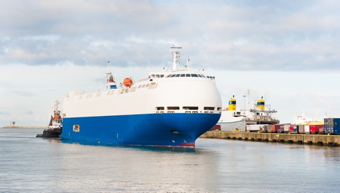
Hydrographic concerns for modern-day large vessels
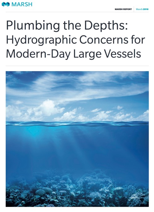
Marsh calls for a higher priority to be given to hydrographic survey work to protect mega-ships at sea – Marsh, a global leader in marine insurance broking and risk management, has issued an industry information report that highlights the inherent risks involved in operating ever-larger ships in poorly surveyed waters: Plumbing the depths: Hydrographic Concerns for Modern-Day Large Vessels. With the Suez Canal axis now open and the expanded Panama Canal system soon to be complete, more and more huge ships will be navigating parts of the world that have never seen so many large vessels before.
In this new research and briefing report Marsh takes a look at the lack of adequately hydrographically surveyed waters internationally and the implications this could have for these new vessels.
MAIB report on Hoegh Osaka

At 2109 on 3 January 2015, the pure car and truck carrier Hoegh Osaka was rounding West Bramble buoy in The Solent (south coast of England, approach to the port of Southampton) when it developed a significant starboard list causing some cargo shift and consequent flooding. With the list in excess of 40°, the ship lost steerage and propulsion, and subsequently drifted onto Bramble Bank, grounding at 2115.
Hoegh Osaka had sailed from the port of Southampton, bound for Bremerhaven, at 2006. A pilot was embarked and there were 24 crew on board. Following the accident, all crew were successfully evacuated from the ship or recovered from the surrounding waters. There was no pollution. A major salvage operation successfully refloated Hoegh Osaka and it was subsequently taken to a safe berth in Southampton on 22 January.
The (UK) Marine Accident Investigation Branch (MAIB) has now published a report into the investigation of the listing, flooding and grounding of this pure car and truck carrier (PCTC).
A safety flyer has been produced highlighting three key safety lessons arising from the accident which the Chief Inspector of Marine Accidents urges the industry to take forward.