US Maritime Advisory – GPS Interference
Towards the end of September the US Maritime Administration (MARAD) issued an advisory notice (No 2020-016) concerning GPS interference.
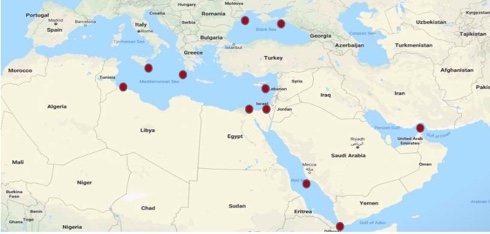
Multiple instances of significant GPS interference have been reported worldwide in the maritime domain. This interference is resulting in lost or inaccurate GPS signals affecting bridge navigation, GPS-based timing, and communications equipment. Satellite communications equipment may also be impacted.
Over the last year, areas from which multiple instances have been reported include the eastern and central Mediterranean Sea, the Persian Gulf, and multiple Chinese ports. The US Transportation Command “Message for Industry” at https://go.usa.gov/xdSpq provides additional GPS interference information.
ESA Discovery studies lay path to navigating the Moon
Just as we navigate our way around Earth’s surface using the connection between our phones and navigation satellites high above us, our missions use the very same satellites to navigate their way in space.
Around ten years ago, engineers started demonstrating that spacecraft outside the orbit of navigation satellites could also navigate in space using ‘spill over’ signal from the satellites.
ESA has invested in the development of an appropriate receiver, and is exploring whether it could be demonstrated on the Lunar Pathfinder mission. It will help lay the groundwork for providing navigation services around the Moon, currently studied through two ESA NAVISP activities and culminating in the Moonlight initiative.
Dr Kimia Shamaei receives the US ION Parkinson Award

On 25 September the (US) Institute of Navigation (ION) announced the presentation of the prestigious Bradford W Parkinson Award to Dr Kimia Shamaei. This took place during the ION GNSS+ 2020 VIRTUAL Conference.
Dr Shamaei was recognized for her thesis, Exploiting Cellular Signals for Navigation: 4G to 5G.
IHO releases new standards for hydrographic surveys

The IHO released earlier this month a new edition of the Standards for Hydrographic surveys (S-44). In addition to surveys to support the safety of navigation, these standards can be adapted for oil and gas, renewable energies, dredging, geophysics, and geotechnics.
By clarifying the required levels of accuracy, they will help define the requirements in terms of technology, time and human resources and will save valuable resources.
ION presents Dr Y Jade Morton with its prestigious Johannes Kepler Award

From Manassas, Virginia, on 25 September the Institute of Navigation’s (ION) Satellite Division reported that it had presented Dr Y Jade Morton with its Johannes Kepler Award during the ION GNSS+ VIRTUAL Conference.
She was recognized for advances in scientific and navigation receiver technology, automated data collection, robust carrier phase tracking, remote sensing, and profound impact as an educator and author.
Dr Morton has made pioneering contributions to the advancement of GNSS receiver technology and utilization of these enhanced capabilities for scientific discovery. Her work brings together scientific rigor with state-of-the-art engineering innovations to simultaneously improve PNT, while revealing remarkable new applications for GNSS.
The Navigation Flashlight 20/2
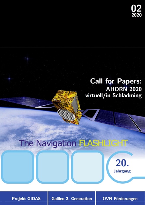
From our Austrian member institute, the Österreichischer Verein für Navigation, we have received word of the latest issue of their regular publication, The Navigation Flashlight. It is published three times a year, currently in its twentieth year of publication and it is in German.
400,000 seafarers stuck at sea as crew change crisis deepens
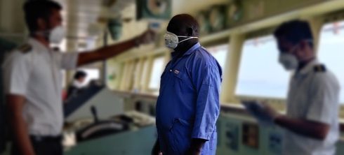
Some 400,000 seafarers from across the globe are now stranded on ships, continuing to work but unable to be relieved, in a deepening crew change crisis which threatens trade and maritime safety.
During a high-level event on the margins of the United Nations General Assembly (24 September), Captain Hedi Marzougui, who was in command of a vessel between December 2019 and May 2020, appealed to Governments to act to allow seafarers to come home: “Not knowing when or if we will be returning home brings a severe mental toll on my crew and myself,” Captain Marzougui said. “I would encourage each and every one of you to think of how you would feel, if you had to work every day, for 12 hours, with no weekends, without seeing your loved ones, and trapped at sea. Now add that you have to do that with no idea of when you will be repatriated.”
UK Government to explore new ways of delivering satnav for the UK
New options for a UK satellite navigation and timing capability programme to support the nation’s critical infrastructure will be explored by the government.
The Space-Based Positioning Navigation and Timing Programme (SBPP) will explore new and alternative ways that could be used to deliver vital satellite navigation services to the United Kingdom which are critical for the functioning of transport systems, energy networks, mobile communications and national security and defence, whilst boosting the British space industry and developing the UK’s own capabilities in these services.
This will follow the work of the UK’s Global Navigation Satellite System (UK GNSS) programme, which is due to conclude at the end of the month.
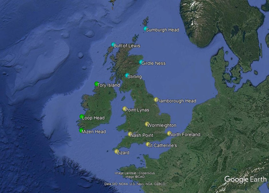
Satnav loss might shut down sea
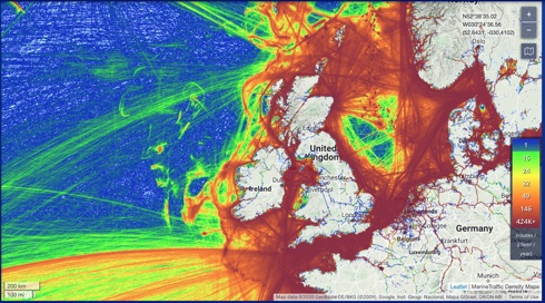
Satellite navigation is precise, reliable and available continuously around the globe, but overreliance on it presents a clear and present danger to the smooth passage of maritime trade, concludes a major ESA-backed study.
“The aim of our Maritime Resilience and Integrity in Navigation, MarRINav, project, was to peer 10 years ahead to see if the needs of mariners for accurate, resilient PNT, would continue to be fulfilled.” according to Jonathan Turner of ‘blue economy’ specialist NLA International, which led the study for ESA.
What the MarRINav team found was that the very success of satellite navigation, in terms of its precision, reliability and always-on availability, is a cause for concern.
ION nominations invited

Nominations for The (US) Institute of Navigation’s (ION) Fellows and Annual Awards Programme are now being accepted. Nominations are due by 15 October.
The ION Annual Awards Programme is sponsored by The Institute of Navigation and recognizes individuals making significant contributions or demonstrating outstanding performance relating to the art and science of Positioning, Navigation, and Timing (PNT).
Members may submit their nominations for the ION’s Fellows and Annual Awards at www.ion.org/awards.
FAA SatNav News Vol. 68 – Winter 2020
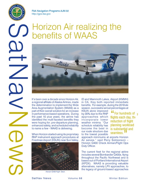
The SatNav News, the Federal Aviation Administration’s satellite navigation newsletter, provides the latest information on FAA satellite navigation initiatives that support the aviation community and the general public. The SatNav News includes articles on the Wide Area Augmentation System (WAAS) and the Ground Based Augmentation System (GBAS) program status, operational issues, research and development activities, FAA’s international satellite navigation initiatives, and other topics related to the ever expanding applications and benefits of GPS and its augmentations.
A Guide to Bulk Carrier Operations
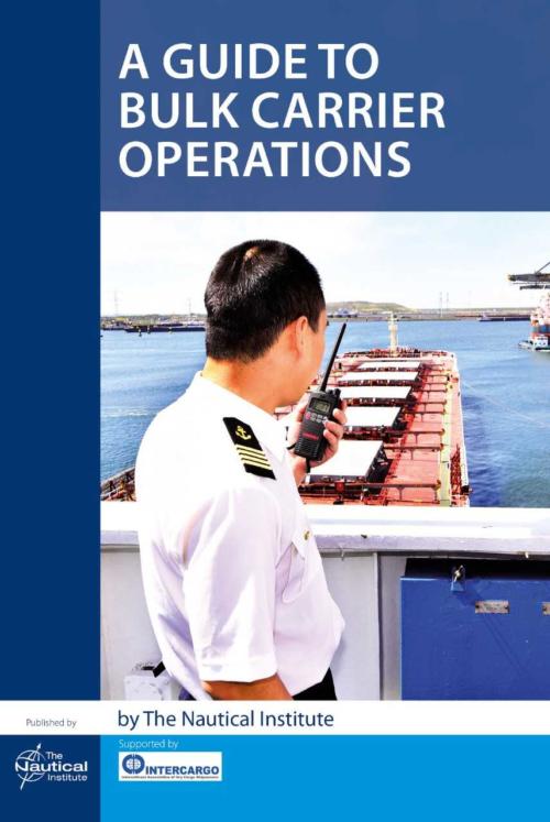
There is no doubt that bulk carriers are some of the workhorses of international maritime trade. Those responsible for operating them need to manage significant risks inherent to the dry bulk trade. Certain cargoes can deplete oxygen, catch fire, explode, corrode holds or simply deteriorate. At terminals, the Master may come under pressure to accept cargoes that are too hot or wet, which could endanger vessel and crew.
In recent years the dry bulk sector has made huge efforts to improve safety, but to quote Intercargo Secretary General Dr Kostas Gkonis: ‘…there is no room for complacency and more work is needed.’
With the support of Intercargo and vetting organisation RightShip, The Nautical Institute has responded by publishing A Guide to Bulk Carrier Operations.
Trump Administration launches first cybersecurity principles for space technologies
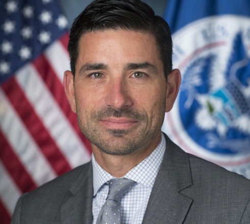
The Trump Administration announced the first comprehensive cybersecurity policy for systems used in outer space and near space on 4 September.
Space Policy Directive-5 (SPD-5) makes clear the lead role the Department of Homeland Security (DHS) and the Cybersecurity and Infrastructure Security Agency (CISA) have in in enhancing the nation’s cyber defences in space, notably on key systems used for global communications, navigation, weather monitoring, and other critical services.
Acting Homeland Security Secretary Chad F Wolf (pictured) commented: ‘From establishing CISA in 2018 to today’s directive to protect American interests on the final frontier, President Trump is empowering the Department of Homeland Security to defend the nation against ever-evolving cyber threats.’
Pacific PNT Conference 2021 – Call for abstracts

Submit your abstract today for The Institute of Navigation’s (ION) Pacific PNT 2021 conference to be held April 19-21, 2021 at the Hilton Waikiki Beach in Honolulu, Hawaii. Abstracts are due November 1, 2020.
Pacific PNT 2020 is organized by the prestigious Pacific Rim Advisory Board and will feature peer reviewed and indexed technical papers presented on a diverse array of topics with special invited sessions being highlighted in BeiDou, COSMIC/FORMOSAT and QZSS as well as a Policy and Status Update Plenary Session. New this year: in-person and virtual presentations will be offered.
The 4th e-Navigation Underway Asia-Pacific Live Conference

The Republic of Korea is about to hosting the 4th e-Navigation Underway Asia-Pacific Conference, including a special showcase of the Maritime Connectivity Platform.
The Republic of Korea’s Ministry of Oceans and Fisheries (MOF) is hosting this virtual e-Navigation Underway Conference (ENUW) from 8-9 September with the theme of Collaborating to harmonize maritime digitalization.
The Conference will be held using a virtual platform, and is being co-organized with the Danish Maritime Administration (DMA) and the International Association of Marine Aids to Navigation and Lighthouse Authorities (IALA).
ION nominations for Fellows and Annual Awards Program

In the US the ION Annual Awards Program is sponsored by The Institute of Navigation and recognises individuals making significant contributions or demonstrating outstanding performance relating to the art and science of Positioning, Navigation, and Timing (PNT).
Readers are invited to submit their nominations at an early date for ION’s Fellows and Annual Awards. Nominations are due by 15 October.
Galileo next-gen satellites on the horizon

Following the European Commission’s decision to accelerate development of Galileo Next Generation, ESA has asked European satellite manufacturers to submit bids for the first batch of the Galileo Second Generation (G2) satellites. The new spacecraft are expected to be launched in about four years.
The next-generation satellites will provide all the services and capabilities of the current first generation, together with a substantial number of improvements as well as new services and capabilities.
Switching off DGPS in the UK
The General Lighthouse Authorities of the UK and Ireland (GLA) have taken the decision to close its DGPS service at the end of March 2022, following user consultation and a considered review of how the system is being used. Other national maritime authorities have also taken the decision to close their DGPS service, while others maintain operations for the foreseeable future – each administration provides the aids to navigation (AtoNs) they deem appropriate for the risks within their waters.
Fourth DRONE ENABLE Symposium postponed to 2021

Due to the ongoing impacts of travel restrictions, public health concerns of large gatherings and uncertainty in the short to medium term caused by COVID-19, ICAO has made the difficult decision to postpone the Fourth DRONE ENABLE Symposium, which was originally scheduled for 9 to 11 September 2020 in Rio de Janeiro, Brazil. The symposium, renamed DRONE ENABLE 2021, will now be held from 13 to 15 April 2021, with the location remaining Rio de Janeiro.
ICAO has extended the submission deadline to 25 September 2020. Those that have already submitted responses are welcome to update their original submission and those that were unable to meet the original timeline are invited to provide a submission by the revised deadline.
ICAO unmanned aviation bulletin 2020-1

On 31 July ICAO issued Unmanned Aviation Bulletin 2020/1, the fifth in the series, reporting on unmanned aviation operational and regulatory developments.
The Bulletin clarifies Key Terms applying to Remotely Piloted Aircraft Systems (RPAS), Unmanned Aircraft Systems (UAS) and related activities.
Readers are invited to freely disseminate this Bulletin to colleagues, members of organisations or constituents.
UK to send emergency relief to Lebanon
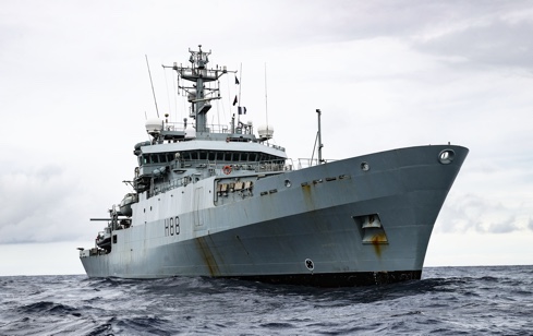
Following the explosion at Beirut Port on 4 August the UK Government announced a package of emergency support to Lebanon, making up to £5 million in emergency humanitarian funding available to help people made homeless by the disaster.
Furthermore, the UK offered enhanced support to the Lebanese Armed Forces, who are central to the Government of Lebanon’s response, including tailored medical help, strategic air transport assistance, and engineering and communications support.
In addition the UK offered to send an EMT advance clinical advisory team who could provide initial assessment and coordination with search and rescue teams.
HMS Enterprise (illustrated) will steam to Lebanon to assess the damage of Beirut’s port and help the port return to normal operations. Deployment of the ship will complement the immediate package of military and civilian support above.
Completion and commissioning of the BeiDou Navigation Satellite System (BDS-3)
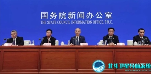
On August 3, 2020, a news conference was held at the State Council Information Office, for announcing that the BDS-3 was formally commissioned. Ran Chengqi, Director General of China Satellite Navigation Office and the spokesperson of the BeiDou Navigation Satellite System, made the introduction.
“On July 31st, General Secretary XI Jinping of the CPC Central Committee announced to the world that BDS-3 was formally commissioned, marking the completion of the ‘three-step’ BDS development strategy, and a new era for BDS to serve the world and benefit mankind.”
RAF Typhoons intercept over the Baltic

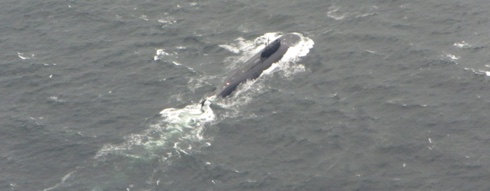
On 31 July the (UK) Ministry of Defence reported that RAF fighter jets operating from Siauliai Air Base, Lithuania on Operation AZOTIZE had intercepted a Russian military formation operating over the Baltic Sea.
The Typhoons approached the Russian formation to identify its composition and established it was an IL-38 MAY Maritime Patrol Aircraft, being escorted by two SU-27 Flanker B Fighters.
This was the first time in recent years that the RAF have seen and intercepted a MAY which was operating alongside a Russian Oscar class submarine, which the Typhoons photographed on the surface as it transited towards the West across the Baltic Sea.
IMO on Digitalization of shipping – more important than ever

Digitalization, big data, and new technologies such as artificial intelligence are key in enabling the post-COVID recovery, IMO Secretary-General Kitack Lim told a 28 July webinar on Digital Connectivity and Data Standards1.
He commented: ‘Cooperation between shipping, ports and logistics will be vital for enhancing the efficiency and sustainability of shipping and therefore facilitating trade and fostering economic recovery and prosperity.’
He highlighted IMO’s key role in ensuring shipping can embrace the digital revolution – while ensuring safety, environmental protection as well as cyber security.
Indian Ocean Tsunami warning exercise

At its 12th session held in Kish Island, Iran in March 2019, the Inter- governmental Coordination Group for the Indian Ocean Tsunami Warning and Mitigation System (ICG/IOTWMS) decided to organise an Indian Ocean Wave Exercise (IOWave20) in 2020 and established a Task Team to plan and conduct the exercise. At its intersessional meeting held in Jakarta, Indonesia on 29 September 2019, the Task Team decided to conduct the IOWave20 exercise on 6, 13 and 20 October 2020.
IOWave20 will simulate Indian Ocean countries being put in a tsunami warning situation and require the National Tsunami Warning Centre (NTWC) and the National and/or Local Disaster Management Offices (NDMO/LDMO) in each country to implement their Standard Operating Procedures (SOPs).