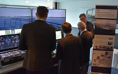
EfficienSea2 results exploited at innovation camp in ROK
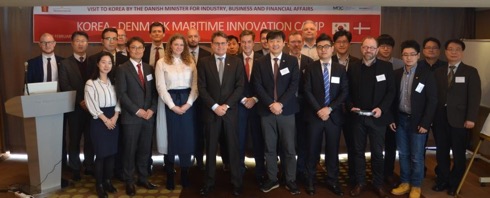
Human factors, new standards for hydrographic data and how best to exploit data were in focus when Korean and European organisations met to collaborate based on the results from the EU-funded project EfficienSea2.
The workshop was opened by Brian Mikkelsen, Danish Minister for Industry, Business and Financial Affairs. On top of European partners, the workshop also had Korean stakeholders such as KJ Engineering, San Engineering, Korea Research Institute of Ships & Ocean Engineering, Korea Advanced Institute of Science & Technology and the Korea Hydrographic & Oceanographic Agency.
The main topics for the workshop were the MCP (Maritime Connectivity Platform), S-100 standards and how human factors played a role in maritime digitalization.
NI appeals for seafarer feedback over S-Mode
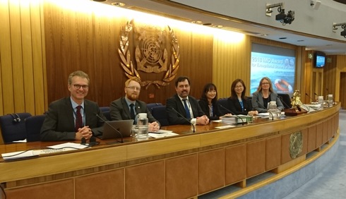
Towards the end of February The Nautical Institute announced a consultation to help assess the latest proposals for standardised navigation equipment. The latest suggestions were presented at IMO’s fifth session of its NCSR (Navigation, Communication and Search and Rescue) Sub-committee by the Institute and other stakeholders including CIRM (Comité International Radio-Maritime), the Western Norway University of Applied Sciences, and delegation members from Australia and the Republic of Korea.
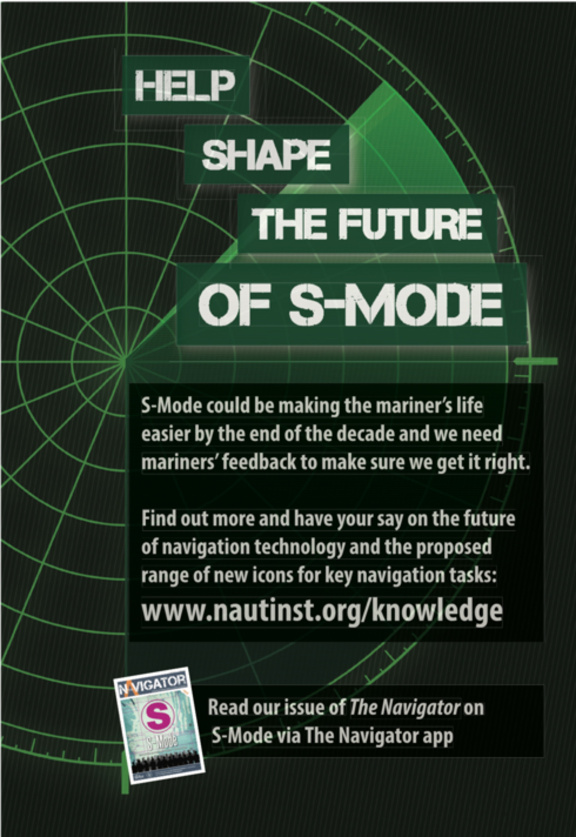
Navigators’ views are sought on the latest concept for S-Mode which is in the closing stages of development before being finalised next year (2019). This is for an ‘always on’ standardisation of key features to be adopted by the leading manufacturers of navigation systems.
New Challenger software speeds electronic delivery

One of the most famous names in the navigational chart business Thomas Gunn (pictured), has underlined his commitment to the digital age in navigation by designing a new Challenger software that will speed up the delivery of digital charts and weekly navigational updates.
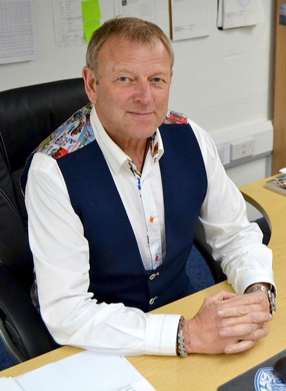
Developed by Poseidon Navigation Services Ltd, an international Admiralty chart agent and digital distributor Gunn has created, Challenger has already received approvals by the Maritime & Coastguard Agency (MCA); the UK Hydrographic Office; as well as a host of flags including Panama, Marshall Islands, Singapore, Isle of Man, to name but a few.
It provides updates for Admiralty Paper Charts & Publications, AVCS, ADP and e-NP digital products and allows the end user to effectively manage onboard holdings, and receive updates either by a direct Web Sync or by receiving weekly e-mail files. Above all, the software will enable the vessel to remain compliant with maritime regulations at all times, it is understood.
(US) Institute of Navigation annual awards


The Institute of Navigation announced winners of the 2017 Annual Awards at its International Technical Meeting and Precise Time and Time Interval Systems and Applications meeting held in Reston, Virginia from 29 January to 1 February.
These awards recognize individuals making significant contributions or demonstrating outstanding performance relating to the art and science of navigation.
Winners of the 8th annual ION Autonomous Snowplow Competition
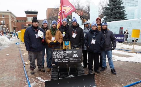
The (US) Institute of Navigation Satellite Division announced the winners of the 8th Annual ION Autonomous Snowplow Competition during the Saint Paul Winter Carnival. The competition was held from 25 to 28 January at Rice Park in downtown Saint Paul, Minnesota in conjunction with the 132nd Saint Paul Winter Carnival.
Sponsored by the ION Satellite Division, and held in cooperation with the ION North Star Section, the ION Annual Autonomous Snowplow Competition is an international event open to college and university students, as well as the general public.
This competition challenges teams to design, build, and operate a fully autonomous snowplow using state of the art navigation and control technologies to rapidly, accurately, and safely clear a designated path of snow. Eleven teams entered the competition.
The EU OCEAN 2020 Project
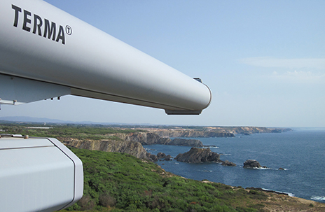
It was announced from Aarhus on 9 February that Danish aerospace, defence and security company Terma will take part in the EU-funded project, OCEAN2020. This project will boost technological research in the maritime domain.
Terma will contribute to the consortium within areas of interoperability requirements analysis, system design, decision support analysis, and operator task analysis.
Danish routeing measures
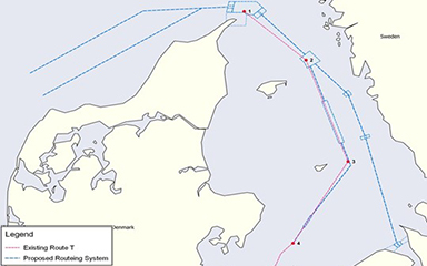
The IMO NCSR Sub-Committee has approved the Danish Maritime Authority’s proposal for new ships’ routeing measures, thereby bringing new routes in the Skagerrak and the Kattegat one step closer and enhancing safety of navigation.
Because of developments in shipping, the vessels transiting these waters today are larger than those for which the routes were originally designed. Approximately 7,000 ships transit the Kattegat each year, the majority of which are deep-draught ships heading for or coming from the Baltic Sea. Consequently, there is a need to extend existing ships’ routes, thereby making it easier to keep the traffic separate in accordance with the largest water depths.
Therefore, the Danish Maritime Authority has – in cooperation with the Swedish Transport Agency and the agencies responsible for nautical charts in both countries – developed proposals for new ships’ routeing measures in the Skagerrak and the Kattegat.
US and Russia propose Bering Strait ship traffic routeing measures
In response to increased Arctic shipping traffic, the United States and the Russian Federation have proposed a system of two-way routes for vessels to follow in the Bering Strait and Bering Sea. This was reported from US Coast Guard HQ in Washington at the end of January.
The two nations jointly developed and submitted the proposal to the International Maritime Organization (IMO) to establish six two-way routes and six precautionary areas.
Located in US and Russian Federation territorial waters off the coasts of Alaska and the Chukotskiy Peninsula, the routes are being recommended to help ships avoid the numerous shoals, reefs and islands outside the routes and to reduce the potential for marine casualties and environmental disasters.
2018 annual workshop of Graduate Students in Systems and Control

Moshe Idan, IAAC President, reports that the call for presentations for GSC’18
– the 2018 annual workshop of Graduate Students in Systems and Control has now been issued.
This event is one in which graduate students in systems and control from Israeli universities are invited to present their latest research results. Such meetings provide an opportunity for graduate students to present their work to senior faculty members and to interested delegates from industry, as well as enabling students to become acquainted with the work of their peers.
24th IMPA Congress, Dakar, Senegal
Work is well in hand for the 24th Congress of the International Maritime Pilots’ Association (IMPA) to be held in Dakar, Senegal, from 22 to 27 April 2018.
A vital aspect of the biennial IMPA Congress is the opportunity for communicating and networking with over 400 pilots and international maritime experts. There will be opportunities to exchange experiences, participate in discussions and to engage with pilots regarding current issues affecting them in particular and the maritime sector in general. In turn such debates will have an impact on the strengthening of pilot safety and the maritime profession, security of port facilities, safety of navigation and the monitoring of ever-increasing vessel sizes.
An introductory item is to be found here.
Atlantic ship tracks

data (2018), processed by ESA, CC BY-SA 3.0 IGO ©
The Copernicus Sentinel-3A satellite in orbit over the Atlantic Ocean close to Spain and Portugal shows where the sky not only features clouds but also crisscross tracks from vessels.
Br />The familiar condensation trails, a.k.a. contrails, seen in the sky usually come from aircraft, so it might seem strange that ships can also occasionally leave their mark in the sky. This rarely seen maritime twist on aircraft contrails was captured by the Sentinel-3A satellite on 16 January 2018. Known as ship tracks, these narrow cloud streaks form when water vapour condenses around
small particles that ships emit in their exhaust fumes. They typically form when low-lying stratus and cumulus clouds are present and when the air surrounding the ship is calm.
Like aircraft contrails, ship tracks may also play a role in our climate by reducing the amount of sunlight that reaches the Earth’s surface or conversely by trapping the Sun’s radiation in the Earth’s atmosphere – but this remains an uncertain aspect of climate science, it is reported.
Survival flair

ESA astronaut Luca Parmitano is seen here gearing up for his second mission to the International Space Station in 2019 on a Russian Soyuz spacecraft. All astronauts who fly on Soyuz do a winter survival course in the forests near Star City, Russia.
When Soyuz lands on Earth support teams are usually at hand within minutes to help the astronauts out, but there is always the possibility that the capsule lands in a remote, cold area. As part of their normal training, astronauts learn to survive in harsh climates while waiting for rescue. For Luca, the course is more of a refresher than learning new skills – he already survived the training in October 2012 as part of his first mission.
This course includes getting out of Soyuz unaided, changing from spacesuits into more winter-friendly garments, signalling for help (as pictured here), building a shelter out of wood and the capsule’s parachute, building a fire and providing first aid.
HMS Queen Elizabeth at Gibraltar
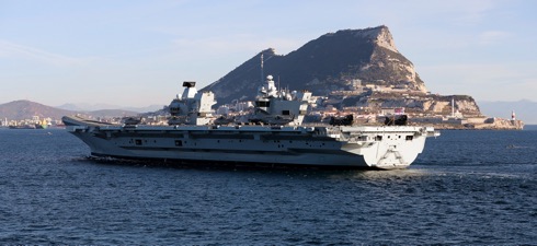
The Royal Navy’s new aircraft carrier HMS Queen Elizabeth arrived in Gibraltar on the forenoon of 9 February for her first overseas port visit.
The 65,000-tonne future flagship will be conducting a routine logistics stop having left her home in Portsmouth last week (w/e 3 February) for helicopter trials. These helicopter trials take place before the fixed wing F35 Lightning II trials later this year.
Under the guidance of the Royal Navy’s Flag Officer Sea Training organisation, all those on board have been honing their skills in dealing with a series of lifelike exercise scenarios including fires, floods, man overboard drills and a simulated crash on deck.
The Navigator helping to develop shiphandling skills
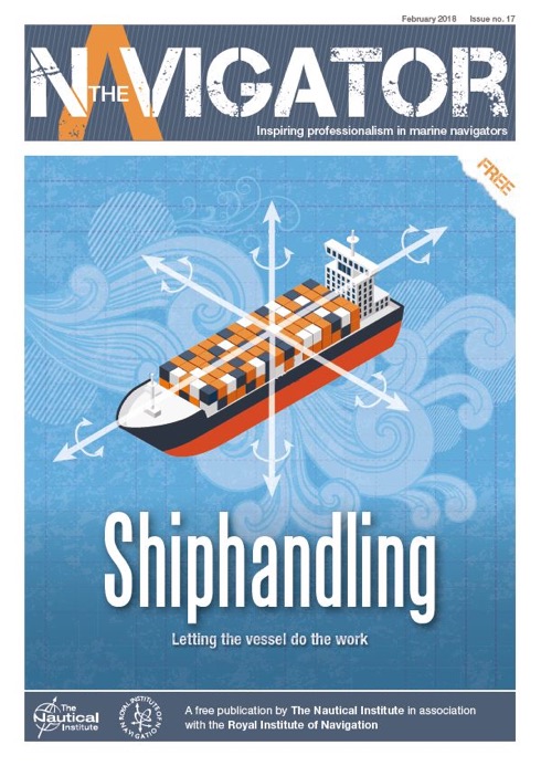
The current issue of The Navigator published on 8 February encourages readers to explore, learn and develop their shiphandling skills and knowledge.
This, the 17th issue of The Navigator, emphasises the value of gaining seatime.
Experts give their valuable perspectives on shiphandling methods, manoeuvres and mentoring with the aim of inspiring readers to take advantage of training opportunities and improve safety and best practice.
The Nautical Institute launches Shiphandling Logbook
Shiphandling is probably the most important skill for mariners and one of the most difficult to practice. The Nautical Institute recognises the value of gaining sea-time and developing shiphandling skills and has now published Shiphandling Logbook, launched on 7 February.
This logbook aims to provide seafarers with an essential tool to help them manage the development of their shiphandling skills and take advantage of training opportunities. Mariners will be able to record and reflect on their experiences, provide evidence of what has been learned, identify gaps and be encouraged to take opportunities to learn more, it has been reported.
New markets for Almarin buoys
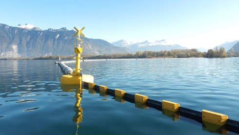
Barcelona-based Almarin’s navigation buoys are being installed in a growing number of markets in Europe and further afield, proving effectiveness by simple reliable design with the use of high quality materials manufactured in Europe, it is reported.
In Léman Lake (Lake Geneva), on the border between France and Switzerland, buoys (illustrated) have been installed to mark a floating containment boom in the estuary of the Rhône river, near Port Valais. The Balizamar buoys used in this project were adapted by the customer for this application.
Almarin has also supplied buoys further east, in an estuary in Beirut (Lebanon) and at Ras Nabi Younis Wastewater Treatment Plant.
Buoys to mark subsea infrastructure related to a water desalination plant have also been exported to Algeria. These products are designed to meet current
IALA recommendations.
e-Navigation paves the way for safe and efficient shipping
The eighth in a series of conferences known as e-Navigation Underway, cohosted by the Danish Maritime Authority and IALA has just closed. 150 Participants from five continents joined the hosts on a conference cruise steaming Copenhagen-Oslo-Copenhagen from 24 to 26 January.
Debate at the conference was lively with a strong focus on applying digitalization to real world uses, it was reported. Some of the specific discussions on digitalization centered on topics such as digital port reporting, cyber security, and how Coastal States can apply new tech to become better at their job.
Harmonization and data standardization was another hot topic. Different standards hinder effective digitalization across the maritime sector leading to more, not less, manual effort. There is need for the industry to strive for global standards.
New Shetland radar to better protect UK’s northern airspace
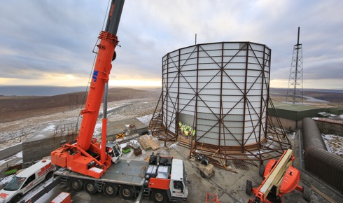
A new Royal Air Force radar facility reinforcing the UK’s ability to track unidentified military or civilian aircraft will be powered up ready to operate soon, the head of the RAF heard today (26 January).
Chief of the Air Staff, Air Chief Marshal Sir Stephen Hillier, visited the site of the new £10m Remote Radar Head facility, at Saxa Vord, Unst, Shetland, to inspect its progress. “Right at the tip of Shetland, Saxa Vord is a very remote site, so I am extremely grateful to the team who have been working hard through the cold of winter, with snow and 120 mph gales, to ensure that the construction has remained on schedule.” (See illustration).
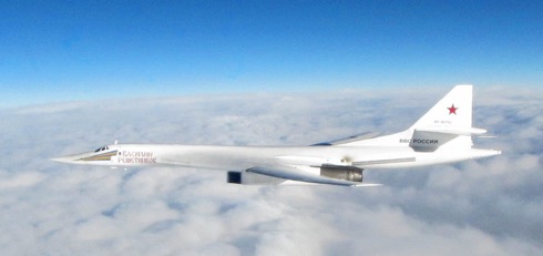
This radar will improve RAF and NATO understanding of the airspace north of Britain and further out across the Norwegian Sea, improving the UK’s sovereign capability at a time of heightened Russian military activity (See illustration). It will see the island return to the role it performed during the 1960s and ’70s, when the site was used as an early warning radar on NATO’s northern flank.
Eamonn Brennan Director General of EUROCONTROL
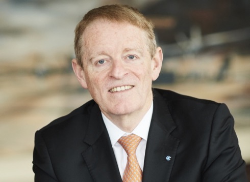
Eamonn Brennan was appointed by the 41 Member States of EUROCONTROL to lead the organisation as its Director General from 1 January 2018. This was reported from EUROCONTROL HQ in Brussels at the beginning of the year.
Before joining EUROCONTROL Eamonn Brennan was the Chief Executive of the Irish Aviation Authority (IAA) where he was responsible for the provision of Air Traffic Management (ATM) services in Irish controlled airspace, aeronautical communications on the North Atlantic, and Air Traffic Control at the major Irish Airports, as well as the safety and security regulation of the Irish civil aviation industry.
It was announced from Brussels earlier in January that in 2017 EUROCONTROL, which has been nominated as Network Manager by the European Commission, handled 10.6 million flights, an increase of 4.4% over 2016, which was also a record year. This is equivalent to over 29,000 flights per day with a peak figure of 35,937 on 30 June.
Yemen conflict forces new security recommendations
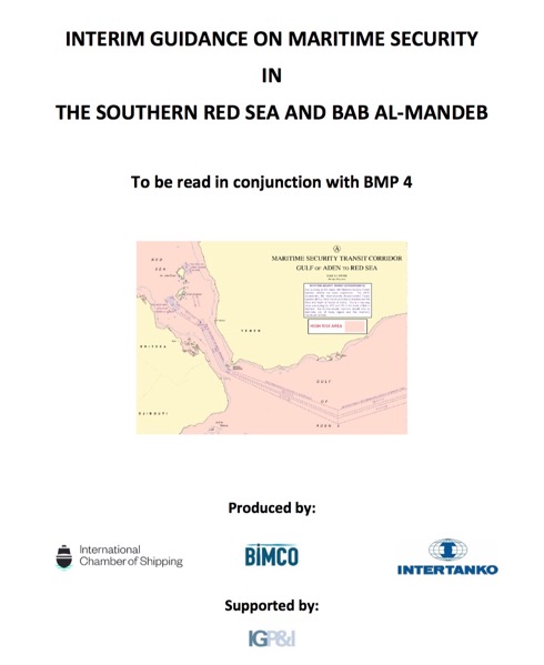
In response to the threats arising from the conflict in Yemen, BIMCO, ICS and INTERTANKO have published interim guidance on maritime security in the southern Red Sea and Bab al-Mandeb. Shipowners and operators should be aware of new threat patterns in the area.
The European Union Naval Force (EUNAVFOR) and the Combined Maritime Forces (CMF) have advised that a range of threats other than piracy, such as sea mines and water-borne improvised explosive devices (WBIEDs), are potential risks in the area.
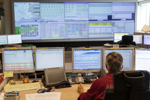
Regional route sharing made possible in the Baltic Sea
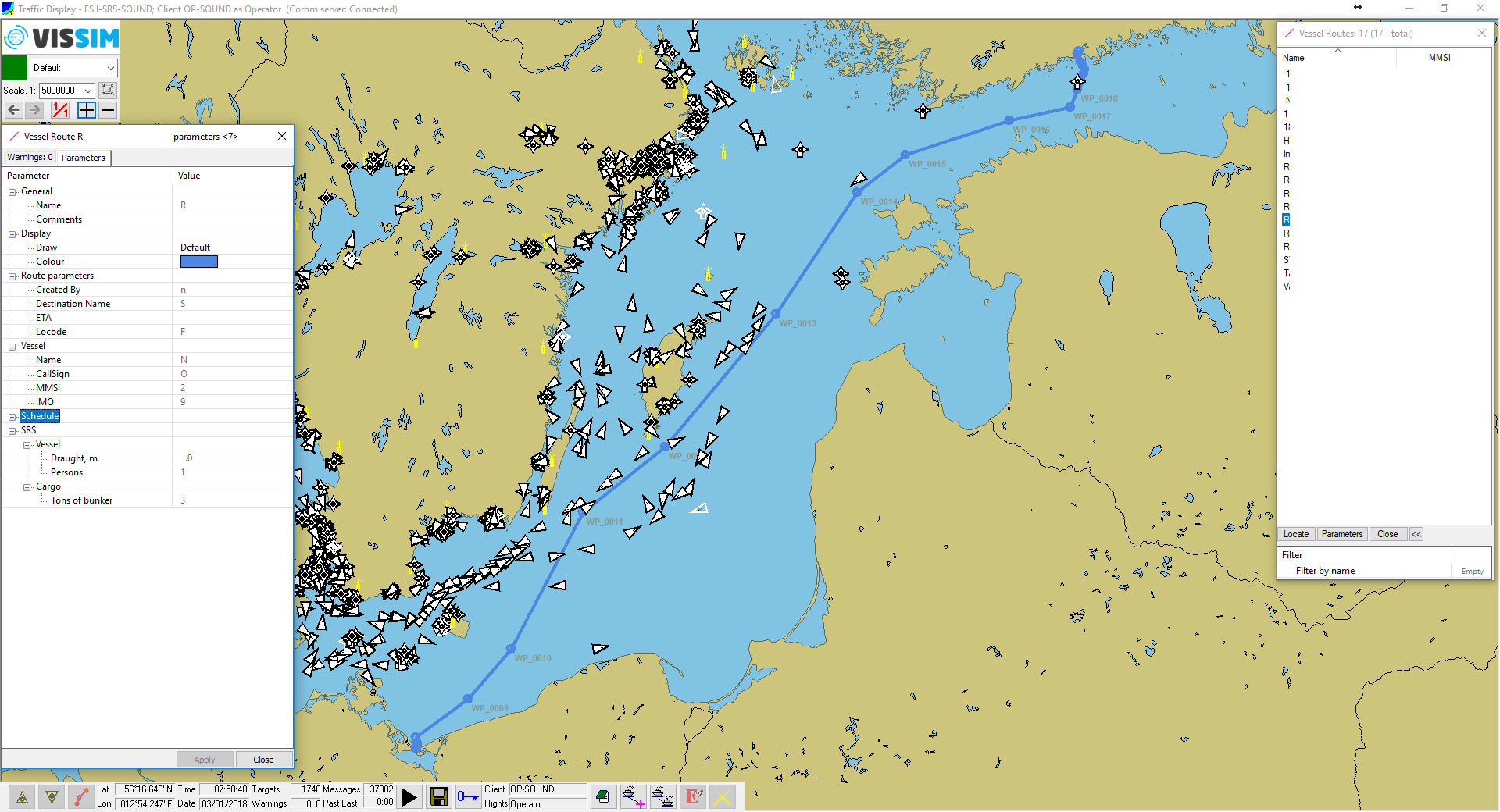
Maritime digitalization carried out in the EfficienSea2 project has enabled effective route sharing between different VTS systems in the Baltic Sea. It has the potential to drastically cut the reporting effort for ship’s crew, while offering authorities a better ability to ensure safe traffic at sea.
According to a statement by EfficienSea2 secretariat the days may soon be over when mariners have to pick up a radio to report their vessel and route parameters every time they cross into a new VTS area – at least for those sailing in the Baltic Sea.
By cooperating with the Finnish Transport Agency in EfficienSea2, the Norwegian surveillance system manufacturer Vissim has become the first operator to integrate voyage data from the so-called ENSI system (Enhanced Navigation Support Information) in their own vessel traffic monitoring system.
IFAC Navigation Systems and Applications
IAIN Member Institute Israeli Association for Automatic Control (IAAC) advises that the Israel Navigation Systems and Applications Workshop and Exhibition is its biennial event organized to serve the wide audience of people in Israel interested in the navigation science and art.
This one-day workshop is dedicated to technical talks that range from fundamental research, to applications, to field test results. The related exhibition is a unique opportunity to bring together in one location the different industries and representatives offering navigation-related hardware.
It is understood that as a relatively large number of participants will be non-Hebrew speakers, lecturers have been asked to deliver their presentations in English.
Airbus descent below segment minimum safe altitude
The Australian Transport Safety Bureau has released the final investigation report into an Airbus A320’s descent below segment minimum safe altitude during a non-precision instrument approach to Perth Airport. This was reported from Canberra on 16 January at 0035GMT
The serious incident highlights the extent to which unexpected events and distractions during the approach and landing can substantially increase what is often a high workload period. That workload increase is even more apparent when the aircraft systems are not operating normally, or the systems are operating in a way that is not fully understood by the crew.
The report highlights the ongoing aviation safety issues of “too low on approach” and “inflight decision making”, which form part of the ATSB’s
SafetyWatch priorities.
Ocean Infinity to continue search for MH370
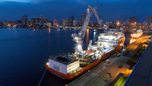
Ocean Infinity, an international technology company specializing in collecting high resolution geophysical seabed data, confirmed on 10 January that its proposal to continue the search for the missing Malaysian Airlines flight MH370 had been accepted by the Government of Malaysia.
It is understood that Ocean Infinity will take on the economic risk of the renewed search, only receiving payment if the aircraft wreckage is located. Ocean Infinity’s search will focus initially on the zone identified by the Australian Transport Safety Bureau. The vessel, Seabed Constructor (illustrated), is now close to the search area, which will enable work to commence imminently and the project is expected to last for 90 days.
ION PLANS Kershner Award nominations now being accepted

Nominations are being accepted for the IEEE/ION Positioning, Location and Navigation Symposium (PLANS) 2018 Kershner Award, the biennial award recognizing individuals who have made substantial contributions to the technology of navigation and position equipment, systems or practices. To nominate an individual readers are invited to submit nominations online by 19 January.
The PLANS Kershner Award will be presented at the IEEE/ION PLANS taking place from 23 to 26 April, 2018 at the Hyatt Regency Monterey, Monterey, California.