NTSB Safer Seas 2013
It was announced from Washington on 12th September that the National Transportation Safety Board has released Safer Seas 2013: Lessons Learned From Marine Accident Investigations, a compilation of accident investigations that were published in 2013, organized by vessel type with links to the more detailed accident reports.
This 39-page report contains a summary and the probable cause of 21 marine accidents in US waters. It brings the lessons learned from these accidents to the maritime community in an easy-to-use summary document.
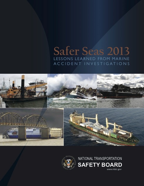
Safer Seas 2013 is available here by kind permission of NTSB ©.
US Dod agrees to share
space data with ROK
On 5th September it was announced from Washington that the Department of Defense has signed a memorandum of understanding to share space situational awareness data with the Republic of Korea’s Defense Ministry.
This accord provides South Korea’s air force with higher-quality and more timely space information tailored for its specific purposes in exchange for satellite-positional and radio-frequency information it will provide to US Strategic Command (TRANSCOM), the DoD agency responsible for space situational awareness, officials said.
 A few weeks before this US agreement with ROK STRATCOM hosted a Space Table Tabletop Exercise (TTX). This brought together key leaders from the Department of Defense and Allied nations, to discuss the integration of space capabilities which provide mission-essential functions in a congested, contested and competitive space environment. – image by the Space and Missile Systems Center courtesy of the 50th Space Wing public web site
Elcome International
to provide Oman coastal
radio communications
network
 © illustration courtesy of Qnective ME and Elcome
It was announced from Dubai, UAE, on 8th September that Elcome International, a marine electronics services, systems and equipment provider in the Middle East and one of the largest marine technology suppliers in the world, is playing a key role in building a new maritime communication network for the Sultanate of Oman.
Under a subcontract awarded in April 2014 by Frequentis AG of Austria, Elcome is supplying key components of the network, as well as system integration, installation, training and maintenance for equipment in the operations centre and at remote sites.
 © illustration courtesy of Qnective ME and Elcome
Transas launches
T-Bridge system
![]() The Transas T-Bridge system presented as SMM 2014 in Hamburg, in September. © Photograph by kind permission of Transas Marine
The Transas T-Bridge system presented as SMM 2014 in Hamburg, in September. © Photograph by kind permission of Transas Marine
On 8th September Transas Marine reported that it had expanded its extensive product range with the launch of the T-Bridge, said to be the most advanced integrated navigation system where professional bridge equipment meets aviation, automation and even tablet technology.
This new Transas T-Bridge, which was being presented at SMM 2014 in Hamburg, brings together diverse systems into a single bridge environment, where data sources are combined to provide a full and clear picture to support efficient decision-making.
RV Investigator

Australia’s marine science community is celebrating the arrival of the new Marine National Facility research vessel Investigator into its home port of Hobart, Tasmania on 9th September.
With almost $20 million worth of scientific equipment, the 94 metre loa vessel is capable of mapping the sea floor at any depth, collecting weather data 20km into the atmosphere, analysing fish species with sonar and revealing the composition of the sea bed 100m below the sea floor.

Online test launched for infringing pilots
![]()
To increase the options it has available to tackle airspace infringements, the UK Civil Aviation Authority (CAA), it was announced on 1st September, may ask pilots who infringe controlled or restricted airspace to sit a short online test to assess their airmanship skills. The test will only be accessible with a secure password, sent by the CAA to the infringing pilot.
The CAA said the move was a further attempt to reduce the large number of airspace infringements still occurring in the UK every year.
Urgency of London & UK’s airport expansion
![]()
Commenting on the Airports Commission’s decision of 2nd September to reject the plan for a Thames estuary airport, Richard Threlfall, KPMG’s UK head of infrastructure, building and construction, said, “The Thames estuary option, for all concerns raised, is a radical and visionary solution to the real capacity and connectivity problem. We have been talking about the capacity issues since the 1960s and we could still be talking about this in 2060. From a business and economic perspective, the conversation has gone on long enough and a decision on the solution needs to be made.”
UK Airports Commission announces inner Thames estuary decision
The UK Airports Commission reported from London on 2nd September that it had announced its decision not to add the inner Thames estuary airport proposal to its shortlist of options for providing new airport capacity by 2030.
Following detailed further study into the feasibility of an inner Thames estuary airport the commission has concluded that the proposal has substantial
disadvantages that collectively outweigh its potential benefits.
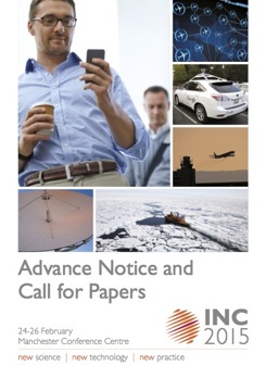
RIN International Navigation Conference

The Royal Institute of Navigation is launching an exciting new international conference series, tackling some of the biggest, most cutting-edge issues across all the domains of modern navigation: land, sea, air and space.
In this first event in a new series of world-class conferences, RIN will be highlighting the state of the art in fields such as GNSS and Galileo; indoor positioning; autonomous transport; security and resilience of navigation in the world of cyber attacks and new quantum technologies.
Take a look at the Advance Notice and Call for Papers.
Galileo Sat 5 & 6 – update
 Artist’s impression of one of the first two Full Operational Capability satellites (SAT 5-6). The pair were launched together aboard a Soyuz rocket, joining the four Galileo satellites already in orbit. The launch, on 22nd August, was from Europe’s Spaceport, French Guiana. The definition, development and in-orbit validation phases of the Galileo programme is currently underway by ESA and co-funded by ESA and the EU. – © ESA / J. Huart, 2014
Operations continue smoothly for Galileo Sat 5-6, it has been reported. Both satellites now have both sets of their solar arrays fully deployed and generating power.
The satellites are safely under control, despite having been released on a lower and elliptical orbit instead of the expected circular orbit on 22nd August.
ESA teams are investigating the possibilities of exploiting the satellites to maximum advantage, despite their non-nominal injection orbits and within the limited propulsion capabilities. Different scenarios will then be assessed before decisions are taken for a recovery mission.
Update on Galileo launch injection anomaly
 Picture reproduced by kind permission of ESA ©
Despite the non-nominal orbit, the satellites are safely under control after they were released from the launcher upper stage and their orbital position was determined by the European ground teams deployed at ESOC in Darmstadt, Germany, it was reported.
Both satellites continue to be kept in a safe state, correctly pointing to the Sun, properly powered and fully under control of the ESA/CNES integrated team and the teams of OHB deployed at ESA’s control centre In parallel, the teams are investigating possibilities to exploit the satellites to their best despite the non-nominal injection orbit and within the limited propulsion capabilities of the satellites.
Soyuz Galileo launch
![]()
The next pair of Galileo satellites, Galileo 5 and 6, were successfully delivered into orbit on 22nd August. This launch marked the start of a new phase in the European satellite navigation programme where the full constellation will be deployed with short intervals between launches.
Galileo 5 & 6 satellites were carried aloft on a Soyuz rocket from the CSG, Europe’s Spaceport in French Guiana at 12:27 GMT (14:27 CEST, 09:27 local time) on 22nd August. All the stages of the Soyuz vehicle performed as planned, with the Fregat upper stage releasing the satellites into their target orbit close to 23,500 km altitude, 3 hours 47 minutes after lift-off.
 Photo reproduced by kind permission of ESA ©
FAA statement – New NOTAM issued for Iraq and Syria
![]() On 8th August the (US) Federal Aviation Administration issued a new Notice-To-Airmen (NOTAM) restricting US operators from flying in the airspace above Iraq due to the hazardous situation created by the armed conflict. The new NOTAM supersedes previous FAA guidance for this airspace.
On 8th August the (US) Federal Aviation Administration issued a new Notice-To-Airmen (NOTAM) restricting US operators from flying in the airspace above Iraq due to the hazardous situation created by the armed conflict. The new NOTAM supersedes previous FAA guidance for this airspace.
Furthermore, on 18th August the FAA issued a new NOTAM restricting US operators from flying in the Damascus Flight Information Region, which includes all of Syria. This replaces the current NOTAM in place that strongly advises US operators against flying in that airspace and requires them to contact the FAA before they operate in that airspace.
Developments in Arctic
shipping operations & infrastructure
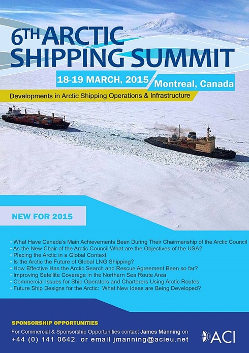
ACI’s 6th Arctic Shipping Summit will take place on 18th and 19th March 2015 in Montreal and will highlight the achievements of Canada’s Chairmanship of the Arctic Council and discuss the USA’s forthcoming plans.
It will review the need for improvements in infrastructure and advancements in technology as well as operational and logistical challenges encountered by shipowners and OSV operators in harsh Arctic conditions. The gathering will address key developments in transport and regulation in the Arctic as well as commercial and safety issues.
UK remote aerial surveys to proceed
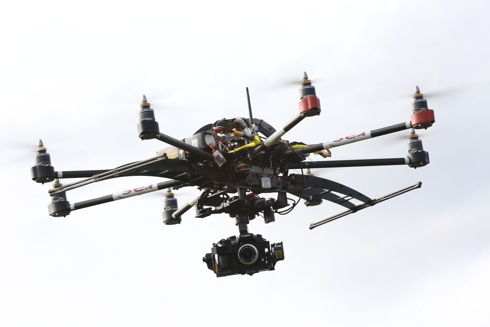
The use of Unmanned Aerial Vehicles (UAVs) – often referred to as drones – to help combat the threat of flooding has been given the official go-ahead to operate on a commercial basis by the United Kingdom Civil Aviation Authority (CAA).
Urban flood specialist Richard Allitt Associates (RAA), based in Haywards Heath in the south of England, has pioneered the use of UAVs, having worked alongside the Environment Agency and a number of water companies, including Severn Trent and Thames Water. The company’s new Remote Aerial Survey business (www.remoteaerialsurveys.co.uk) already has three qualified pilots and a number of UAVs capable of carrying imaging equipment designed to conduct diverse aerial surveys.
CILT urges government
to grasp aviation strategy
![]() As the Airports Commission develops its thinking on the UK’s future airport strategy for government consideration during 2015, the Chartered Institute of Logistics and Transport (CILT) has now produced its own report outlining long-term strategic prospects for the growth of air transport.
As the Airports Commission develops its thinking on the UK’s future airport strategy for government consideration during 2015, the Chartered Institute of Logistics and Transport (CILT) has now produced its own report outlining long-term strategic prospects for the growth of air transport.
Entitled The Future of Aviation, the CILT’s key point is that the economic,
environmental, and social benefits of aviation are only likely to be optimised if
the UK prospers at least to the same level as the rest of the world. As an
international activity the benefits to the UK from air transport will be not be
realised in isolation.
Trimble announces land-based 3D piling application
It was announced from Sunnyvale, California on 23rd July that Trimble had introduced its DPS900 piling system, a dedicated, land-based 3D machine control system for a variety of piling applications. Accuracy of the system is said to allow piling contractors to increase operational efficiency and reduce costs in the construction of building foundations, retaining walls, coffer dams, and solar or wind farm installations.
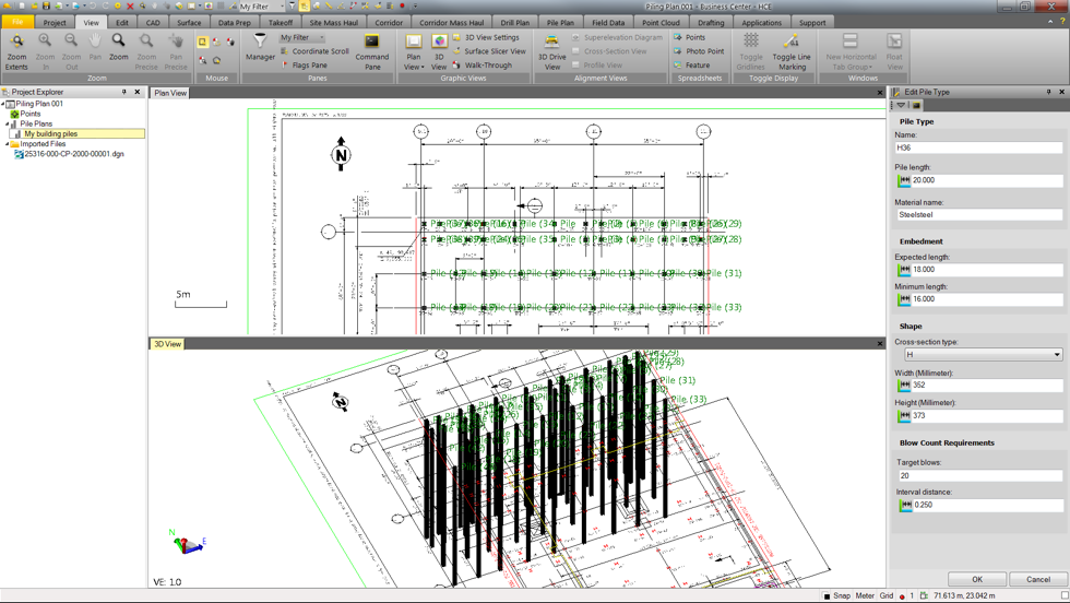 Trimble piling plan
 Trimble DPS 900 screenshot
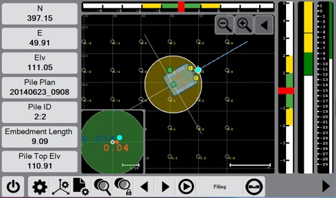
 Trimble site tablet that runs the DPS 900 software in the piledriver’s cab
 Trimble Zephyr Model 2 rugged antenna
Cammell Laird completes
first year of second
RFA cluster term
Merseyside shipyard and engineering services company Cammell Laird has completed the first year of the second five-year period of its cluster contract with the RFA, it was reported in mid-July.
Cammell Laird CEO John Syvret said the first anniversary marked a period of significant progress and added that the company would now be redoubling its efforts to deliver the best possible service to the RFA. He emphasized that the RFA contract plays a key role in the company’s rapid growth in the commercial marine, offshore wind and civil nuclear markets. He said that the stringent health and safety, project management and quality requirements demanded by the MoD helped significantly in other markets.
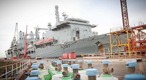 RFA Fort Victoria in Cammell Laird’s Birkenhead yard
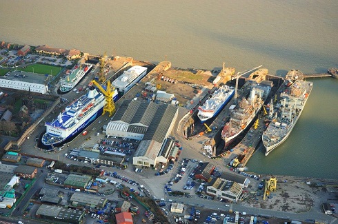 Aerial photograph of the shipyard with RFA and commercial vessels
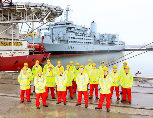 Latest apprentice intake with RFA Fort Rosalie
CANSO welcomes efforts
to improve sharing of
information and intelligence
in the light of MH17
![]()
Following the downing of Flight MH17, the Civil Air Navigation Services Organisation (CANSO) called on States to share information and intelligence so that airlines can make informed decisions about the safest routes to fly. This announcement was made from Montreal on 29th July. CANSO welcomes the establishment of a high-level Task Force agreed today that will urgently address this issue and the overall safety of aircraft over conflict zones.
IFALPA statement on MH17
![]()
In light of recent events impacting the aviation industry the International Federation of Air Line Pilots’ Associations has released a Special Edition of its e-News Broadcast which is partly reproduced here by kind permission of IFALPA – The Global Voice of Pilots / La voix des pilotes dans le monde.
“Given the recent press releases and statements, everyone is outraged at the shooting down of Malaysian Airlines Flight 17, and we should be. This violent act against our air transport system – peacefully engaging in global commerce – cannot be tolerated. Just as we did in the era of hijackings and following events where our own aircraft were used as weapons against us in acts of terror, we must take action.”
EASA and the Eastern Ukraine region
![]() On 18th July the European Aviation Safety Agency (EASA) published a Safety Information Bulletin (SIB), taking into consideration the reported loss of flight MH17 in Eastern Ukraine. (See pdf here).
On 18th July the European Aviation Safety Agency (EASA) published a Safety Information Bulletin (SIB), taking into consideration the reported loss of flight MH17 in Eastern Ukraine. (See pdf here).
Kongsberg Norcontrol IT contributes to enhance sea border protection
With the final conference due in September and following the second and final trial campaign which took place at the end of June this year, the I2C (Integrated System for Interoperable sensors & Information sources for Common abnormal vessel behaviour detection and Collaborative identification of threat) integration project has resulted in significant breakthroughs for enhancing sea border protection, it is understood.
Kongsberg Norcontrol’s I2C was implemented to enable automatic identification and tracking of vessels suspected of involvement in, for example, irregular migration, illegal fishing, drug trafficking and looting of cultural heritage.
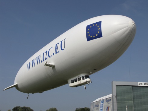 Kongsberg Norcontrol’s I2C has resulted in significant breakthroughs for
enhancing sea border protection
Flight MH17 – Ukraine
On 17th July EUROCONTROL was informed that Malaysia Airlines Flight MH 17 en route from Amsterdam to Kuala Lumpur crashed in the eastern part of Ukraine.
According to information with EUROCONTROL the aircraft was flying at Flight Level 330 (approximately 10,000 metres/33,000 feet) when it disappeared from the radar. This route had been closed by the Ukrainian authorities from ground to flight level 320 but was open at the level at which the aircraft was flying.
ESA ship tracking
by satellite
![]() ESA will improve the identification and tracking of vessels anywhere on earth from 2018 under a public-private partnership with LuxSpace of Luxembourg and exactEarth of Canada, signed on 15th July at Farnborough International Air Show in the UK and running until 20th July.
ESA will improve the identification and tracking of vessels anywhere on earth from 2018 under a public-private partnership with LuxSpace of Luxembourg and exactEarth of Canada, signed on 15th July at Farnborough International Air Show in the UK and running until 20th July.
Large vessels and all passenger ships irrespective of size are mandated by the IMO to carry AIS equipment. It transmits the course and speed as well as identification and position information to other vessels and shore stations.
While AIS has been deployed globally, it suffers from a major limitation because earth’s curvature limits its horizontal range to about 74 km from shore. This means that AIS traffic information sent out by vessels’ beacons is available only around coastal zones or on a ship-to-ship basis.
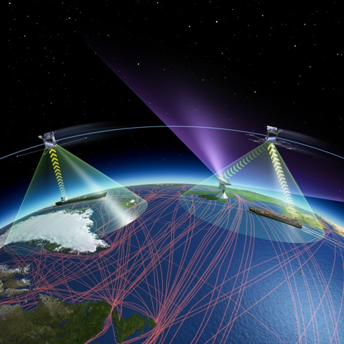 ESA will improve satellite-based ship identification and tracking in partnership with the European Maritime Safety Agency and exactEarth to meet the requirements of users, particularly those of government agencies such as coastal administrations. – illustration reproduced by kind courtesy of ESA ©
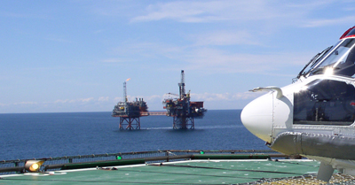
Helicopter pilots welcome call for improved safety
![]() Helicopter pilots operating around Britain’s shores and represented by the British Airline Pilots’ Association (BALPA) welcomed the findings of a UK Parliament House of Comons Transport Select Committee report into offshore helicopter safety, issued earlier this month.
Helicopter pilots operating around Britain’s shores and represented by the British Airline Pilots’ Association (BALPA) welcomed the findings of a UK Parliament House of Comons Transport Select Committee report into offshore helicopter safety, issued earlier this month.
General Secretary of BALPA, Jim McAuslan, said, “The Transport Select Committee report adds further weight to the urgent need for safety improvements to prevent accidents and make every offshore flight a safe one.”