GNSS hardening against interference
GNSS receivers are vulnerable to interference, due to the low received signal powers. These low signal power levels motivate the use of spread spectrum techniques. It has been shown that unintentional RF interference (RFI) is ubiquitous. In close proximity to the GNSS frequency bands, services are active for satellite communications, TV broadcasting, radar and Ultra Wide Band (UWB) applications. These services can cause out-of-band emissions, harmonics or inter-modulation products. The weak signal environment, presence of intentional and unintentional interference and the use of GNSS in critical applications argue for an impact assessment of RFI.
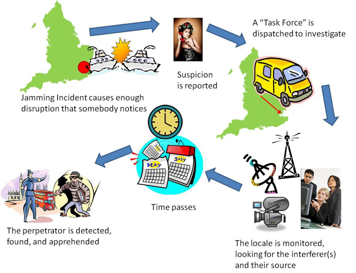
This article was first published in the Trinity House Service journal FLASH© and appears here by kind permission of the authors and Editor
Swedish coastal radio network modernisation
© Rickard Gillberg/SMA
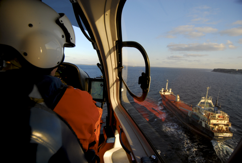
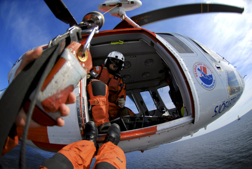
The Swedish coastal radio network is a cornerstone of search and rescue activities in Swedish waters and is considered to be the mariner’s communication lifeline. It was announced on 2nd August that the Swedish Maritime Administration is now investing some SEK 50 million to improve and modernise the system. “The coastal radio network is a fundamental part of our maritime infrastructure. The planned investment will improve its stability and increase maritime safety even further”, said Jon Granstedt, the Administration’s President of Construction and Engineering.
© Rickard Gillberg/SMA
Galileo spreads its wings
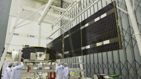
Deployment of the solar wings on the latest Galileo satellite is shown above being checked at ESA’s technical hub in The Netherlands. The navigation satellite’s pair of 1 metre x 5 metre solar wings, carrying more than 2500 stateof-the-art gallium arsenide solar cells, will power the satellite during its 12-year working life, it was reported on 11th July.
UK rollout of eLoran
The UK’s pursuit of technology to counter the threat of GPS jamming has achieved a significant milestone, and is setting the benchmark across the globe.

It was announced on 17th July that seven differential eLoran stations will be installed along the South and East coast of the UK, following approval by the Department for Transport. The stations will provide alternative position, navigation and timing (PNT) information to ensure that ships equipped with eLoran receivers can navigate safely in the event of GPS failure in one of the busiest shipping regions in the world.
St. Lawrence river UKC management
Australian maritime engineering firm OMC International (OMC) has won a major Canadian contract for its DUKC® electronic navigation system to operate in the St Lawrence River, further cementing OMC’s reputation as a leading provider of Under Keel Clearance (UKC) management, Executive Director Dr Terry O’Brien announced in mid-June. He said a customised web-based DUKC® Series 5 system for the draught-restricted section of the St Lawrence River from Montreal to Quebec City is expected to be operational next year as part of Montreal Port Authority’s (MPA) and the Canadian Coast Guard’s (CCG) integrated e-Navigation solution for the St Lawrence River.
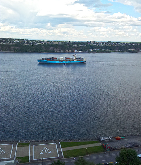
Containership on the St Lawrence at Quebec City (© OMC)
CANSO environment concern

On 20th June it was announced from Curacao that the organisation had called on States to adopt global measures to mitigate the environmental impact of aviation.
States are urged to reach agreement on a basket of reforms proposed by the aviation industry at the 38th Session of the ICAO Assembly in September. These will enable the industry to achieve its goal of carbon neutral growth from 2020 and include measures on operations, infrastructure, and technology as well as market-based measures.

CANSO initiative on runway safety

It was announced from Curacao on 17th June that CANSO, the Civil Air Navigation Services Organisation, has launched a major initiative to improve runway safety at airports. The initiative provides a runway safety checklist for airports and air navigation service providers (ANSPs) as well as key tips for both pilots and air traffic controllers.
As well as the key tips for pilots and ATCOs, the material that is being launched includes a revised and updated education booklet Unstable Approaches – ATC Considerations, as well as an app that can be downloaded to smart devices such as tablets and smartphones from www.cansosafety.com.
New IALA publications

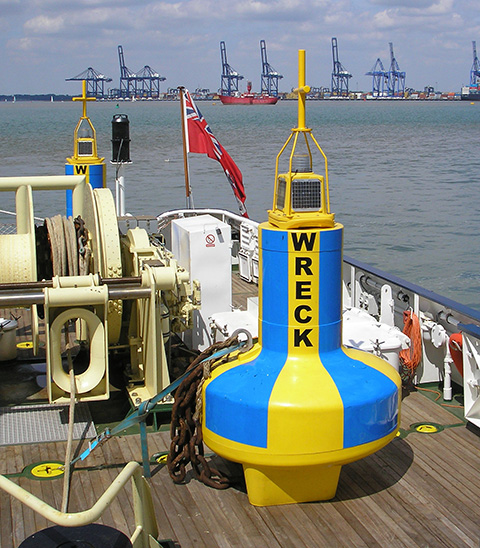
The International Association of Marine Aids to Navigation and Lighthouse Authorities (IALA) has recently issued new documents providing information and advice to its members.
NTSB Delta Mariner accident report
 On 14th May the National Transportation Safety Board (NTSB) announced from Washington that it had determined that the 2012 allision of mv Delta Mariner with the Eggner’s Ferry Bridge in Kentucky was caused by the reliance of the vessel’s bridge team on the independent contract pilot who provided incorrect navigational direction. Contributing factors included the failure of deck officers on the vessel to use all available navigation tools to verify the vessel’s position and proper route under the bridge; the failure of the crew to prepare an adequate detailed passage plan; and, the lack of effective management and oversight of the bridge lighting system.
Transas Marine FleetView Online
Transas Marine announced on 23rd April that it had released a new version of its FleetView Online web-based SSAS1-tracking service. This claims improved user interface, object overlay and chart navigation controls. Object overlay on the charts, it is understood, have been updated to enhance visual appearance and improve user experience at lower scales.
![]()
Indonesian Navy full bridge simulator
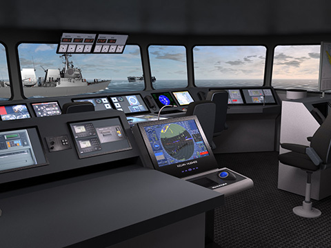
For training of its Sigma Class Corvette bridge personnel, the Indonesian Navy and Ministry of Defence selected VSTEP to supply two Class A NAUTIS Full Mission Bridge (FMB) Simulators for its Kobangdikal marine training facility in Surabaya it was reported by VSTEP from Rotterdam and Surabaya on 18th April 2013.

Report on the seventh ICG meeting
The Seventh Meeting of the International Committee on GNSS (ICG) was held in Beijing, China from 5 to 9 November 2012. The meeting was hosted by the Government of the People’s Republic of China. IAIN was represented by Elisabeth Fischer (OVN).
Seventh ICG meeting – joint statement
The Seventh Meeting of the International Committee on Global Navigation Satellite
Systems (ICG) was held in Beijing, China from 4 to 9 November 2012, to continue
reviewing and discussing developments in Global Navigation Satellite Systems (GNSS) and to allow ICG members, associate members, and observers to address recent developments in their organizations and associations with regard to GNSS services and applications.
Obituary Captain David Smith OBE FNI RN
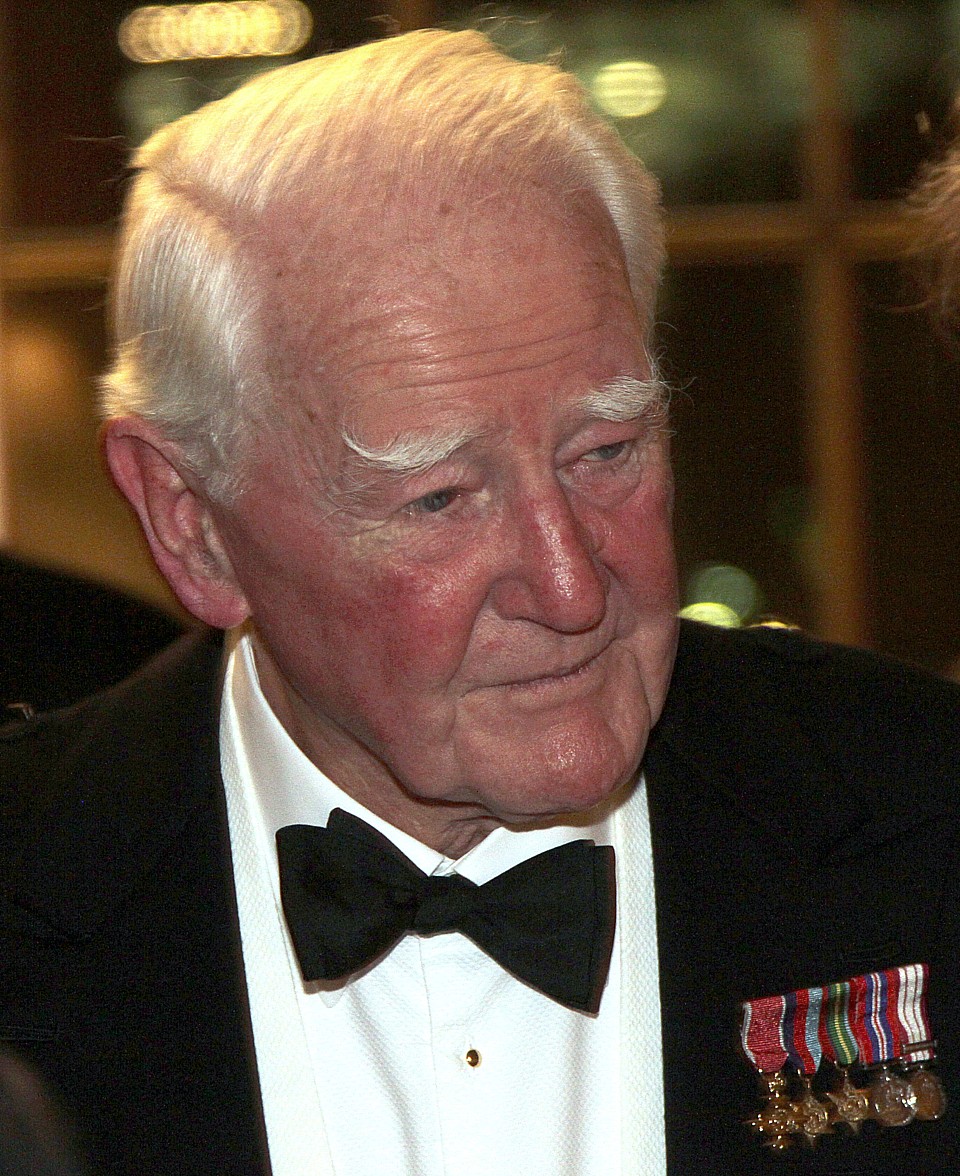
It is with regret that we report the passing of Captain David T Smith OBE FNI RN, Elder Brother of Trinity House, who died in Malta on 23rd March 2013, after a short illness at the age of 86. He was sworn as an Elder Brother in 1976 and retired from employment, in February 1992. However, he remained actively engaged with the Corporation’s work and aims as a member of the Court until his death.

HMS Trincomalee, berthed afloat at Jackson Dock, within Hartlepool’s
Maritime Experience.
ICAO Indonesia accord

It was announced from Montreal on 27th March by the International Civil Aviation Organization (ICAO) formalization of a new project with Indonesia, aimed at improving the management and reduction of its aviation carbon emissions.
The large-scale Environmental Measures Project will be undertaken between Indonesia’s Ministry of Transport and ICAO’s Technical Co-operation Bureau (ICAO-TCB). This reflects Indonesia’s determination to meaningfully address the environmental performance of its air transport sector over the near- and
longer-term, while additionally supporting recent Presidential Decrees on greenhouse gas emissions.

MONALISA 2.0 – moving maritime into the digital age
It was reported on 27th March that the Swedish Maritime Administration has initiated an extension of the ongoing MONALISA project, called MONALISA 2.0 through a renewed application to the European Commission’s TEN-T programme.
MONALISA 2.0 takes its point of departure in the results and experiences from
the current MONALISA project, co-financed by TEN-T under the Motorways of the Sea and which has received very positive feedback from stakeholders, international bodies and the European Commission.
Upcoming events
The EUGIN website publishes details of links to forthcoming events.
IAIN General Assembly September 2012 minutes
The minutes of the IAIN General Assembly that took place at 1500 hrs. on September 30, 2012, in the Zurich Room of the Concorde El Salam Hotel, Cairo, Egypt, as part of the IAIN World Congress.
IAIN General Assembly September 2012 minutes
The minutes of the IAIN General Assembly that took place at 1500 hrs. on September 30, 2012, in the Zurich Room of the Concorde El Salam Hotel, Cairo, Egypt, as part of the IAIN World Congress.
Thirty ECDIS for Turkey
A strong run of orders for MARIS has culminated in a 30-system deal covering the delivery of its ECDIS900 system to Turkish customers, it was reported from Nøtterøy, Norway on 22nd March.
This deal highlights the longstanding relationship between MARIS and wellknown marine electronics distribution and service specialist STT International Ltd. It covers existing and future STT requirements to deliver MARIS ECDIS900 to Turkish owners and shipyards. STT reports that the first systems are committed to general cargo vessel newbuildings due for delivery to Yildirim Group from the Marmara Shipyard before the end of 2013.

Ralf Pluch, MARIS Director Sales Europe
BP Shipping Marine Distance Tables
A recent upgrade to AtoBviaC’s end user applications for the BP Shipping Marine Distance Tables now means that users can adjust routes and obtain distances to match their own operations. The changes make it possible for the user to produce deviation reports following changes in voyage destinations.
Tanker owners, operators, charterers and shipmasters are often faced with evaluating changes in trading patterns due to geo-political events and oil supply and demand imbalances. They are used to relying upon AtoBviaC’s BP Shipping Marine Distance Tables to provide accurate and viable distances, based on actual routes, to estimate true costs and to maximise potential profit.
JNC 2013 cancelled
Lisa Beaty, Executive Director of the (US) Institute of Navigation announces with sincere regret that the Institute of Navigation (ION) Military Division must cancel this year’s Joint Navigation Conference (JNC) in Orlando, Florida, originally scheduled for 10th to 13th June 2013.
Apparently this decision has not been taken lightly, but due to the Department of Defense recent policies detailing actions to be taken to prepare for drastic budget cuts, the curtailment of travel, fallout from a scandal with GSA conferences this past year, the current sequestration, and possible furloughs for federal employees, it is no longer possible for ION to ensure the JNC will be
able to maintain a high quality technical program and sufficient networking opportunities that makes the JNC so valuable to Department of Defense / Department of Homeland Security employees and their supporting organizations.
European Navigation Conference
Stephan Mayer, President of the Austrian Institute of Navigation, OVN, reports high interest of the navigation community in the ENC. More than 150 oral presentations and 50 poster presentations will be featured in 32 sessions.
PENS Intre-centre coordination in Europe
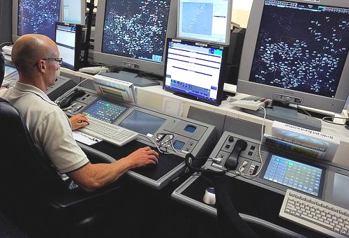
It was announced from Brussels on 5th March that the Pan European Network Service (PENS) is now the operational network for the exchange of coordination messages between the Air Traffic Control (ATC) Centres of NATS in Swanwick (UK) and the Maastricht Upper Area Centre (MUAC) in The Netherlands. PENS allows ATC Centres to exchange flight information data securely and efficiently by using IP (Internet Protocol) Version 6 (IPv6) as required by the Flight Message Transfer Protocol (FMTP) Implementing Rule.
Information exchanges between flight data processing systems are established between air traffic control units for the notification, co-ordination and transfer of flights as well as for civil-military co-ordination.
These information exchanges need appropriate and harmonised communication protocols to secure their interoperability – and PENS provides this service.
Satellite controlled trains
Taking a cue from how ESA controls satellites, Spanish railways now have their own high-tech upgrade to keep travellers abreast of when the next train is going to arrive.
Drawing on sophisticated software that keeps satellites on track, the system was developed by a group of Elecnor Deimos engineers who had worked extensively on ESA projects. The outcome of this technology transfer is that up-to-date train schedules are now displayed at over 400 Spanish stations.
