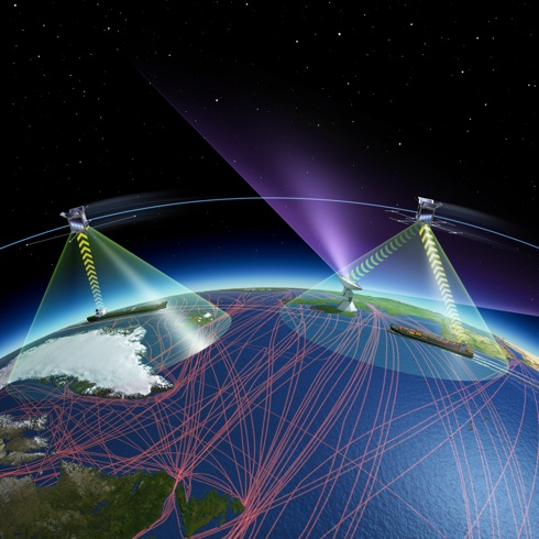
ESA ship tracking
by satellite
 ESA will improve the identification and tracking of vessels anywhere on earth from 2018 under a public-private partnership with LuxSpace of Luxembourg and exactEarth of Canada, signed on 15th July at Farnborough International Air Show in the UK and running until 20th July.
Large vessels and all passenger ships irrespective of size are mandated by the IMO to carry AIS equipment. It transmits the course and speed as well as identification and position information to other vessels and shore stations.
While AIS has been deployed globally, it suffers from a major limitation because earth’s curvature limits its horizontal range to about 74 km from shore. This means that AIS traffic information sent out by vessels’ beacons is available only around coastal zones or on a ship-to-ship basis.
 ESA will improve satellite-based ship identification and tracking in partnership with the European Maritime Safety Agency and exactEarth to meet the requirements of users, particularly those of government agencies such as coastal administrations. – illustration reproduced by kind courtesy of ESA ©
