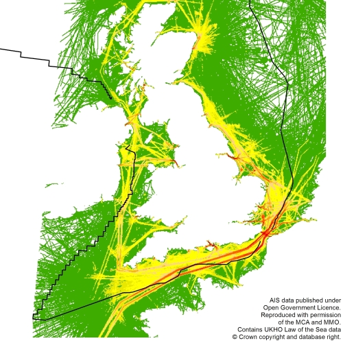
Mapping UK shipping density and routes from AIS
A Marine Management Organisation report Mapping UK shipping density and routes from AIS (MMO 1066) which outlines an investigation of spatial trends in shipping activity around the UK, authored by ABPmer, has recently been published.
As part of the study, ABPmer developed a series of flexible data processing tools and associated geographic information system (GIS) procedures to decode and display automatic identification system (AIS) data from vessels for the whole of the UK. This work follows on from ABPmer’s previously published MMO1042 Shipping Activity Project, which primarily concerned the South Marine Plan Area.

